Mārom Golan geodata
Mārom Golan (Northern District) is a israeli settlement; located in Israel in Asia/Jerusalem (GMT+3) time zone. With population of 700 people, there are 162 cities with bigger population in this country. Compared to other cities in Israel, 98.8% of cities are located further ↓South; 99.4% of cities are located further ←West and 100% of cities have lower elevation than Mārom Golan. Note1


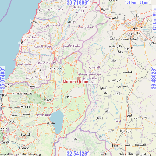
Mārom Golan GPS coordinates[2]
33° 7' 55.308" North, 35° 46' 37.74" East
| Map corner | latitude | longitude |
|---|---|---|
| Upper-left | 33.71886°, | 35.07403° |
| Center: | 33.13203°, | 35.77715° |
| Lower-right: | 32.54126°, | 36.48028° |
| Map W x H: | 130.9×130.9 km | = 81.3×81.3mi |
| max Lat: | 33.27918° ⇑1.2% North |
| Mārom Golan: | 33.13203° |
| min Lat: | ⇓98.8% South 29.55805° |
| min Long | Mārom Golan | max Long |
| 34.57149° | 35.77715° | 35.81084° |
| W 99.4%⇐ | ⇒0.59999999999999% E |
Elevation
Elevation of Mārom Golan is 988 m = 3241 ft, and this is 764.6 m = 2509 ft above average elevation for this country.
| Max E: |
988 m = 3241 ft | 0% |
| Mārom Golan | 988 m 3241 ft | |
| Avg. | 223.4 m = 733 ft | |
Min E: |
-380 m = -1247 ft | 100% |
See also: Israel elevation on elevation.city.
Geographical zone
Mārom Golan is located in North temperate zone (between Tropic of Cancer and the Arctic Circle). Distance of this Northern Tropic circle is 1078 km =669.8 mi to South.| Distance of | km | miles | from Mārom Golan |
|---|---|---|---|
| North Pole | 6323.1 | 3929 | to North |
| Arctic Circle | 3717.2 | 2309.8 | to North |
| Tropic Cancer | 1078 | 669.8 | to South |
| Equator | 3683.9 | 2289.1 | to South |


Nearby cities:
15 places around Mārom Golan: (largest is in red/bold)
• Al Buţayḩah
28.3 km =17.6 mi,  208°
208°
• Al Khushnīyah
15.1 km =9.4 mi,  167°
167°
• Beit Jann
41.3 km =25.7 mi,  243°
243°
• Buqei‘a
44.8 km =27.8 mi,  247°
247°
• Fīq
39.9 km =24.8 mi,  190°
190°
• Jīsh
33.1 km =20.6 mi, 248°
• Maghār
43.8 km =27.2 mi,  232°
232°
• Metulla
24.6 km =15.3 mi,  311°
311°
• Pasuta
44.6 km =27.7 mi,  258°
258°
• Qiryat Shemona
20.8 km =12.9 mi,  293°
293°
• Rosh Pinna
28.4 km =17.6 mi, 230°
• Safed
32.1 km =19.9 mi, 234°
• Sājūr
45.8 km =28.5 mi, 242°
• Tiberias
44.2 km =27.5 mi, 211°
• Ḥurfeish
41.9 km =26 mi, 252°
Sources, notices
• [Note1] Compared only with cities in Israel existing in our database
• [Src1] Map data: © OpenStreetMap contributors (CC-BY-SA)
• [Src2] Other city data from geonames.org with taken over terms of usage.
• [Src3] Geographical zone / Annual Mean Temperature by Robert A. Rohde @ Wikipedia
