Bellampalli geodata
Bellampalli (Telangana) is a populated place; located in India in Asia/Kolkata (GMT+5.5) time zone. With population of 66,660 people, there are 650 cities with bigger population in this country. Compared to other cities in India, 68.4% of cities are located further ↑North; 63.7% of cities are located further ←West and 50.7% of cities have lower elevation than Bellampalli. Note1


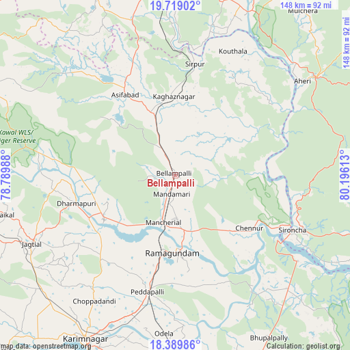
Bellampalli GPS coordinates[2]
19° 3' 20.772" North, 79° 29' 34.8" East
| Map corner | latitude | longitude |
|---|---|---|
| Upper-left | 19.71902°, | 78.78988° |
| Center: | 19.05577°, | 79.493° |
| Lower-right: | 18.38986°, | 80.19613° |
| Map W x H: | 147.8×147.8 km | = 91.8×91.8mi |
| max Lat: | 34.9274° ⇑68.4% North |
| Bellampalli: | 19.05577° |
| min Lat: | ⇓31.6% South 8.09008° |
| min Long | Bellampalli | max Long |
| 68.82655° | 79.493° | 96.81° |
| W 63.7%⇐ | ⇒36.3% E |
Elevation
Elevation of Bellampalli is 206 m = 676 ft, and this is 89.6 m = 294 ft below average elevation for this country.
| Max E: |
3681 m = 12077 ft | 49.3% |
| Avg. | 295.6 m = 970 ft | |
| Bellampalli | 206 m = 676 ft | |
Min E: |
1 m = 3 ft | 50.7% |
See also: Bellampalli elevation on elevation.city.
Geographical zone
Bellampalli is located in North Torrid zone (between Equator and Tropic of Cancer). Distance of this Northern Tropic circle is 487.1 km =302.7 mi to North.| Distance of | km | miles | from Bellampalli |
|---|---|---|---|
| North Pole | 7888.3 | 4901.6 | to North |
| Arctic Circle | 5282.4 | 3282.3 | to North |
| Tropic Cancer | 487.1 | 302.7 | to North |
| Equator | 2118.8 | 1316.6 | to South |


Nearby cities:
15 places around Bellampalli: (largest is in red/bold)
• Ahiri
66.8 km =41.5 mi,  53°
53°
• Allāpalli
73.1 km =45.4 mi,  55°
55°
• Asifābād
40.2 km =25 mi,  326°
326°
• Jagtiāl
67.2 km =41.8 mi,  244°
244°
• Kagaznāgār
30.8 km =19.1 mi,  354°
354°
• Kothāpet
32.9 km =20.4 mi,  358°
358°
• Lakshettipet
35.9 km =22.3 mi,  234°
234°
• Mancherāl
21.7 km =13.5 mi,  198°
198°
• Mandamarri
10.3 km =6.4 mi,  190°
190°
• Manthani
48.5 km =30.1 mi,  158°
158°
• Nāspur
23.6 km =14.7 mi, 188°
• Peddapalli
50.7 km =31.5 mi, 194°
• Ramagundam
33.5 km =20.8 mi,  183°
183°
• Rāmgundam
28.7 km =17.8 mi, 188°
• Sirpur
47.9 km =29.8 mi,  10°
10°
Sources, notices
• [Note1] Compared only with cities in India existing in our database
• [Src1] Map data: © OpenStreetMap contributors (CC-BY-SA)
• [Src2] Other city data from geonames.org with taken over terms of usage.
• [Src3] Geographical zone / Annual Mean Temperature by Robert A. Rohde @ Wikipedia
