Thang geodata
Thang (Jammu and Kashmir) is a populated place; located in India in Asia/Kolkata (GMT+5.5) time zone. With population of 1,622 people, there are 3447 cities with bigger population in this country. Compared to other cities in India, 100% of cities are located further ↓South; 65.1% of cities are located further →East and 99.8% of cities have lower elevation than Thang. Note1


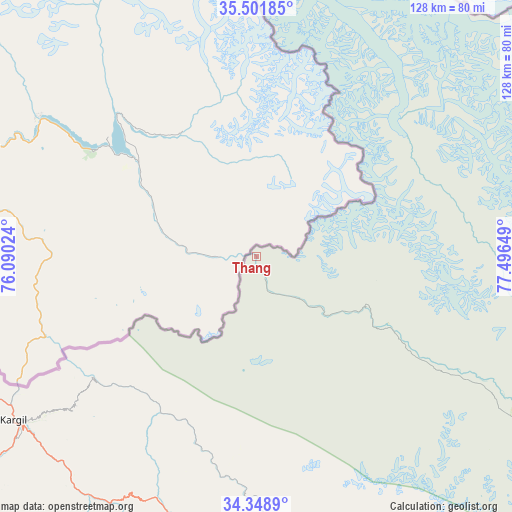
Thang GPS coordinates[2]
34° 55' 38.64" North, 76° 47' 36.096" East
| Map corner | latitude | longitude |
|---|---|---|
| Upper-left | 35.50185°, | 76.09024° |
| Center: | 34.9274°, | 76.79336° |
| Lower-right: | 34.3489°, | 77.49649° |
| Map W x H: | 128.2×128.2 km | = 79.7×79.7mi |
| max Lat: | 34.9274° ⇑0% North |
| Thang: | 34.9274° |
| min Lat: | ⇓100% South 8.09008° |
| min Long | Thang | max Long |
| 68.82655° | 76.79336° | 96.81° |
| W 34.9%⇐ | ⇒65.1% E |
Elevation
Elevation of Thang is 2726 m = 8944 ft, and this is 2430.4 m = 7974 ft above average elevation for this country.
| Max E: |
3681 m = 12077 ft | 0.2% |
| Thang | 2726 m 8944 ft | |
| Avg. | 295.6 m = 970 ft | |
Min E: |
1 m = 3 ft | 99.8% |
See also: India elevation on elevation.city.
Geographical zone
Thang is located in North temperate zone (between Tropic of Cancer and the Arctic Circle). Distance of this Northern Tropic circle is 1277.6 km =793.9 mi to South.| Distance of | km | miles | from Thang |
|---|---|---|---|
| North Pole | 6123.5 | 3805 | to North |
| Arctic Circle | 3517.6 | 2185.7 | to North |
| Tropic Cancer | 1277.6 | 793.9 | to South |
| Equator | 3883.6 | 2413.2 | to South |


Nearby cities:
15 places around Thang: (largest is in red/bold)
• Anantnag
200.9 km =124.8 mi,  228°
228°
• Awantipur
197.9 km =123 mi,  235°
235°
• Bandipura
204.6 km =127.1 mi,  253°
253°
• Bijbehara
199.6 km =124 mi, 230°
• Gāndarbal
200.6 km =124.6 mi, 247°
• Hājan
211.1 km =131.2 mi, 250°
• Kargil
73.5 km =45.7 mi, 236°
• Kishtwār
202.8 km =126 mi,  207°
207°
• Leh
111.5 km =69.3 mi,  139°
139°
• Padam
162.6 km =101 mi,  177°
177°
• Pahlgām
168.9 km =104.9 mi, 233°
• Pulwama
209.5 km =130.2 mi, 236°
• Qāzigund
208.7 km =129.7 mi, 226°
• Srinagar
204.8 km =127.3 mi, 242°
• Trāl
189.8 km =117.9 mi, 234°
Sources, notices
• [Note1] Compared only with cities in India existing in our database
• [Src1] Map data: © OpenStreetMap contributors (CC-BY-SA)
• [Src2] Other city data from geonames.org with taken over terms of usage.
• [Src3] Geographical zone / Annual Mean Temperature by Robert A. Rohde @ Wikipedia
