Padam geodata
Padam (Jammu and Kashmir) is a populated place; located in India in Asia/Kolkata (GMT+5.5) time zone. With population of 25,000 people, there are 1701 cities with bigger population in this country. Compared to other cities in India, 99.2% of cities are located further ↓South; 64.5% of cities are located further →East and 100% of cities have lower elevation than Padam. Note1


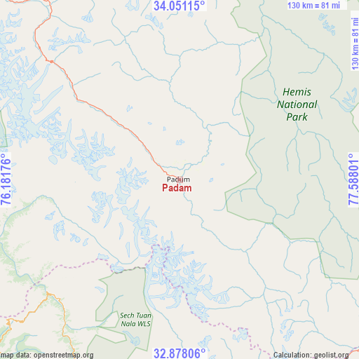
Padam GPS coordinates[2]
33° 27' 59.724" North, 76° 53' 5.568" East
| Map corner | latitude | longitude |
|---|---|---|
| Upper-left | 34.05115°, | 76.18176° |
| Center: | 33.46659°, | 76.88488° |
| Lower-right: | 32.87806°, | 77.58801° |
| Map W x H: | 130.4×130.4 km | = 81×81mi |
| max Lat: | 34.9274° ⇑0.8% North |
| Padam: | 33.46659° |
| min Lat: | ⇓99.2% South 8.09008° |
| min Long | Padam | max Long |
| 68.82655° | 76.88488° | 96.81° |
| W 35.5%⇐ | ⇒64.5% E |
Elevation
Elevation of Padam is 3560 m = 11680 ft, and this is 3264.4 m = 10710 ft above average elevation for this country.
| Max E: |
3681 m = 12077 ft | 0% |
| Padam | 3560 m 11680 ft | |
| Avg. | 295.6 m = 970 ft | |
Min E: |
1 m = 3 ft | 100% |
See also: India elevation on elevation.city.
Geographical zone
Padam is located in North temperate zone (between Tropic of Cancer and the Arctic Circle). Distance of this Northern Tropic circle is 1115.2 km =693 mi to South.| Distance of | km | miles | from Padam |
|---|---|---|---|
| North Pole | 6285.9 | 3905.9 | to North |
| Arctic Circle | 3680 | 2286.6 | to North |
| Tropic Cancer | 1115.2 | 693 | to South |
| Equator | 3721.1 | 2312.2 | to South |


Nearby cities:
15 places around Padam: (largest is in red/bold)
• Bakloh
142 km =88.2 mi,  219°
219°
• Batoti
151.5 km =94.1 mi,  255°
255°
• Bhadarwāh
121.4 km =75.4 mi,  243°
243°
• Chamba
123.6 km =76.8 mi,  214°
214°
• Chowari
141 km =87.6 mi, 215°
• Chuāri Khās
141 km =87.6 mi, 215°
• Dalhousie
134.1 km =83.3 mi, 220°
• Dharamsala
148.3 km =92.1 mi,  200°
200°
• Doda
129.2 km =80.3 mi,  254°
254°
• Kargil
140 km =87 mi,  330°
330°
• Kishtwār
105.1 km =65.3 mi, 260°
• Kyelang
100.3 km =62.3 mi,  172°
172°
• Leh
101 km =62.8 mi,  39°
39°
• Manāli
137.1 km =85.2 mi, 168°
• Nagar
150.2 km =93.3 mi, 169°
Sources, notices
• [Note1] Compared only with cities in India existing in our database
• [Src1] Map data: © OpenStreetMap contributors (CC-BY-SA)
• [Src2] Other city data from geonames.org with taken over terms of usage.
• [Src3] Geographical zone / Annual Mean Temperature by Robert A. Rohde @ Wikipedia
