Bakloh geodata
Bakloh (Punjab) is a populated place; located in India in Asia/Kolkata (GMT+5.5) time zone. With population of 1,737 people, there are 3444 cities with bigger population in this country. Compared to other cities in India, 98.5% of cities are located further ↓South; 74.4% of cities are located further →East and 97.2% of cities have lower elevation than Bakloh. Note1


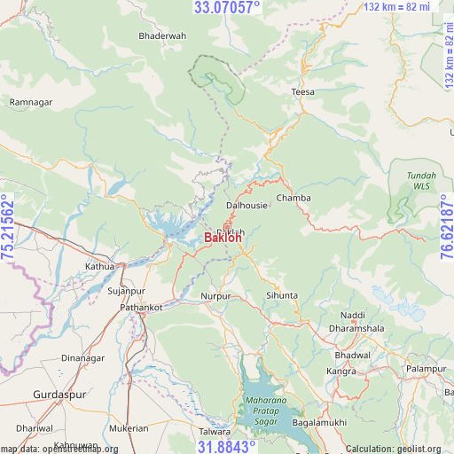
Bakloh GPS coordinates[2]
32° 28' 45.804" North, 75° 55' 7.464" East
| Map corner | latitude | longitude |
|---|---|---|
| Upper-left | 33.07057°, | 75.21562° |
| Center: | 32.47939°, | 75.91874° |
| Lower-right: | 31.8843°, | 76.62187° |
| Map W x H: | 131.9×131.9 km | = 82×82mi |
| max Lat: | 34.9274° ⇑1.5% North |
| Bakloh: | 32.47939° |
| min Lat: | ⇓98.5% South 8.09008° |
| min Long | Bakloh | max Long |
| 68.82655° | 75.91874° | 96.81° |
| W 25.6%⇐ | ⇒74.4% E |
Elevation
Elevation of Bakloh is 1336 m = 4383 ft, and this is 1040.4 m = 3413 ft above average elevation for this country.
| Max E: |
3681 m = 12077 ft | 2.8% |
| Bakloh | 1336 m 4383 ft | |
| Avg. | 295.6 m = 970 ft | |
Min E: |
1 m = 3 ft | 97.2% |
See also: India elevation on elevation.city.
Geographical zone
Bakloh is located in North temperate zone (between Tropic of Cancer and the Arctic Circle). Distance of this Northern Tropic circle is 1005.5 km =624.8 mi to South.| Distance of | km | miles | from Bakloh |
|---|---|---|---|
| North Pole | 6395.7 | 3974.1 | to North |
| Arctic Circle | 3789.8 | 2354.9 | to North |
| Tropic Cancer | 1005.5 | 624.8 | to South |
| Equator | 3611.4 | 2244 | to South |


Nearby cities:
15 places around Bakloh: (largest is in red/bold)
• Chamba
21.2 km =13.2 mi,  66°
66°
• Chowari
10.2 km =6.3 mi,  121°
121°
• Chuāri Khās
10.5 km =6.5 mi, 121°
• Dalhousie
8.5 km =5.3 mi,  17°
17°
• Daulatpur
57 km =35.4 mi,  145°
145°
• Dharamsala
47.5 km =29.5 mi,  127°
127°
• Dīnānagar
56.6 km =35.2 mi,  227°
227°
• Hājipur
57.9 km =36 mi,  195°
195°
• Kathua
38.9 km =24.2 mi,  251°
251°
• Kotla
27.7 km =17.2 mi,  157°
157°
• Kāngar
53.9 km =33.5 mi,  143°
143°
• Nagrota
49.7 km =30.9 mi, 160°
• Parol
47.8 km =29.7 mi, 251°
• Pathānkot
33.8 km =21 mi, 227°
• Yol
43.7 km =27.2 mi, 143°
Sources, notices
• [Note1] Compared only with cities in India existing in our database
• [Src1] Map data: © OpenStreetMap contributors (CC-BY-SA)
• [Src2] Other city data from geonames.org with taken over terms of usage.
• [Src3] Geographical zone / Annual Mean Temperature by Robert A. Rohde @ Wikipedia
