Wani geodata
Wani (Maharashtra) is a populated place; located in India in Asia/Kolkata (GMT+5.5) time zone. With population of 57,288 people, there are 770 cities with bigger population in this country. Compared to other cities in India, 65% of cities are located further ↑North; 58.7% of cities are located further ←West and 54.5% of cities have lower elevation than Wani. Note1


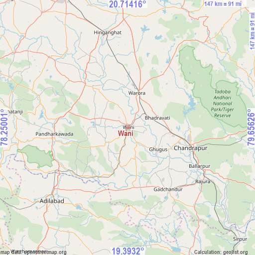
Wani GPS coordinates[2]
20° 3' 18.252" North, 78° 57' 11.268" East
| Map corner | latitude | longitude |
|---|---|---|
| Upper-left | 20.71416°, | 78.25001° |
| Center: | 20.05507°, | 78.95313° |
| Lower-right: | 19.3932°, | 79.65626° |
| Map W x H: | 146.9×146.9 km | = 91.3×91.3mi |
| max Lat: | 34.9274° ⇑65% North |
| Wani: | 20.05507° |
| min Lat: | ⇓35% South 8.09008° |
| min Long | Wani | max Long |
| 68.82655° | 78.95313° | 96.81° |
| W 58.7%⇐ | ⇒41.3% E |
Elevation
Elevation of Wani is 224 m = 735 ft, and this is 71.6 m = 235 ft below average elevation for this country.
| Max E: |
3681 m = 12077 ft | 45.5% |
| Avg. | 295.6 m = 970 ft | |
| Wani | 224 m = 735 ft | |
Min E: |
1 m = 3 ft | 54.5% |
See also: Wani elevation on elevation.city.
Geographical zone
Wani is located in North Torrid zone (between Equator and Tropic of Cancer). Distance of this Northern Tropic circle is 376 km =233.6 mi to North.| Distance of | km | miles | from Wani |
|---|---|---|---|
| North Pole | 7777.1 | 4832.5 | to North |
| Arctic Circle | 5171.3 | 3213.3 | to North |
| Tropic Cancer | 376 | 233.6 | to North |
| Equator | 2229.9 | 1385.6 | to South |


Nearby cities:
15 places around Wani: (largest is in red/bold)
• Ballālpur
47.1 km =29.3 mi,  119°
119°
• Chānda
37.6 km =23.4 mi,  107°
107°
• Chāndur
42.3 km =26.3 mi,  147°
147°
• Dasnapur
64.2 km =39.9 mi,  225°
225°
• Durgāpur
36.9 km =22.9 mi,  98°
98°
• Ghugus
21.1 km =13.1 mi,  128°
128°
• Ghātanji
67.5 km =41.9 mi,  278°
278°
• Hinganghāt
56.2 km =34.9 mi,  347°
347°
• Kyathampalle
61.8 km =38.4 mi, 225°
• Mūl
75.8 km =47.1 mi,  88°
88°
• Rājur
8.8 km =5.5 mi,  314°
314°
• Rājūra
52.8 km =32.8 mi, 125°
• Sonegaon
69.4 km =43.1 mi,  336°
336°
• Warora
20 km =12.4 mi,  15°
15°
• Ādilābād
61 km =37.9 mi, 225°
Sources, notices
• [Note1] Compared only with cities in India existing in our database
• [Src1] Map data: © OpenStreetMap contributors (CC-BY-SA)
• [Src2] Other city data from geonames.org with taken over terms of usage.
• [Src3] Geographical zone / Annual Mean Temperature by Robert A. Rohde @ Wikipedia
