Rājur geodata
Rājur (Maharashtra) is a populated place; located in India in Asia/Kolkata (GMT+5.5) time zone. With population of 11,934 people, there are 2747 cities with bigger population in this country. Compared to other cities in India, 64.9% of cities are located further ↑North; 58% of cities are located further ←West and 53.8% of cities have lower elevation than Rājur. Note1


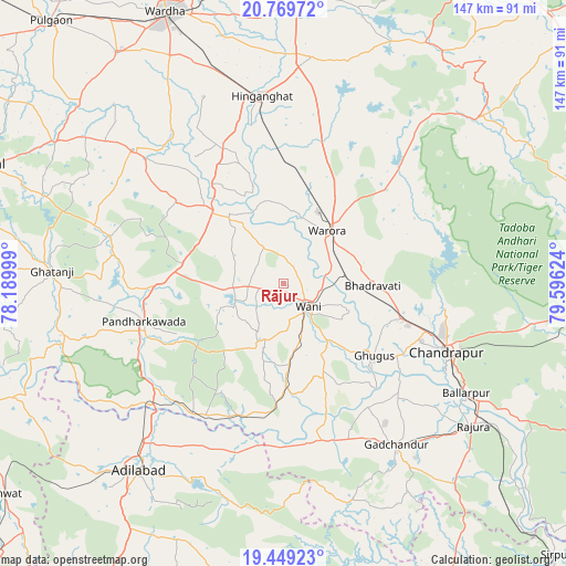
Rājur GPS coordinates[2]
20° 6' 39.132" North, 78° 53' 35.196" East
| Map corner | latitude | longitude |
|---|---|---|
| Upper-left | 20.76972°, | 78.18999° |
| Center: | 20.11087°, | 78.89311° |
| Lower-right: | 19.44923°, | 79.59624° |
| Map W x H: | 146.8×146.8 km | = 91.2×91.2mi |
| max Lat: | 34.9274° ⇑64.9% North |
| Rājur: | 20.11087° |
| min Lat: | ⇓35.1% South 8.09008° |
| min Long | Rājur | max Long |
| 68.82655° | 78.89311° | 96.81° |
| W 58%⇐ | ⇒42% E |
Elevation
Elevation of Rājur is 221 m = 725 ft, and this is 74.6 m = 245 ft below average elevation for this country.
| Max E: |
3681 m = 12077 ft | 46.2% |
| Avg. | 295.6 m = 970 ft | |
| Rājur | 221 m = 725 ft | |
Min E: |
1 m = 3 ft | 53.8% |
See also: India elevation on elevation.city.
Geographical zone
Rājur is located in North Torrid zone (between Equator and Tropic of Cancer). Distance of this Northern Tropic circle is 369.8 km =229.8 mi to North.| Distance of | km | miles | from Rājur |
|---|---|---|---|
| North Pole | 7770.9 | 4828.6 | to North |
| Arctic Circle | 5165.1 | 3209.4 | to North |
| Tropic Cancer | 369.8 | 229.8 | to North |
| Equator | 2236.1 | 1389.4 | to South |


Nearby cities:
15 places around Rājur: (largest is in red/bold)
• Ballālpur
55.7 km =34.6 mi,  121°
121°
• Chānda
45.6 km =28.3 mi,  112°
112°
• Chāndur
51 km =31.7 mi,  145°
145°
• Dasnapur
64.6 km =40.1 mi,  218°
218°
• Deoli
73.7 km =45.8 mi,  324°
324°
• Durgāpur
44.4 km =27.6 mi, 105°
• Ghugus
29.9 km =18.6 mi,  130°
130°
• Ghātanji
60.6 km =37.7 mi,  273°
273°
• Hinganghāt
49 km =30.4 mi,  353°
353°
• Kyathampalle
62.3 km =38.7 mi, 217°
• Rājūra
61.5 km =38.2 mi, 126°
• Sonegaon
61.3 km =38.1 mi,  340°
340°
• Wani
8.8 km =5.5 mi, 134°
• Warora
17.4 km =10.8 mi,  41°
41°
• Ādilābād
61.4 km =38.2 mi, 217°
Sources, notices
• [Note1] Compared only with cities in India existing in our database
• [Src1] Map data: © OpenStreetMap contributors (CC-BY-SA)
• [Src2] Other city data from geonames.org with taken over terms of usage.
• [Src3] Geographical zone / Annual Mean Temperature by Robert A. Rohde @ Wikipedia
