Hinganghāt geodata
Hinganghāt (Maharashtra) is a populated place; located in India in Asia/Kolkata (GMT+5.5) time zone. With population of 97,568 people, there are 452 cities with bigger population in this country. Compared to other cities in India, 63.5% of cities are located further ↑North; 57.5% of cities are located further ←West and 55.6% of cities have lower elevation than Hinganghāt. Note1


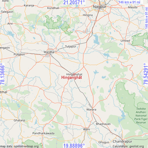
Hinganghāt GPS coordinates[2]
20° 32' 55.5" North, 78° 50' 23.208" East
| Map corner | latitude | longitude |
|---|---|---|
| Upper-left | 21.20571°, | 78.13666° |
| Center: | 20.54875°, | 78.83978° |
| Lower-right: | 19.88896°, | 79.54291° |
| Map W x H: | 146.4×146.4 km | = 91×91mi |
| max Lat: | 34.9274° ⇑63.5% North |
| Hinganghāt: | 20.54875° |
| min Lat: | ⇓36.5% South 8.09008° |
| min Long | Hinganghāt | max Long |
| 68.82655° | 78.83978° | 96.81° |
| W 57.5%⇐ | ⇒42.5% E |
Elevation
Elevation of Hinganghāt is 228 m = 748 ft, and this is 67.6 m = 222 ft below average elevation for this country.
| Max E: |
3681 m = 12077 ft | 44.4% |
| Avg. | 295.6 m = 970 ft | |
| Hinganghāt | 228 m = 748 ft | |
Min E: |
1 m = 3 ft | 55.6% |
See also: Hinganghāt elevation on elevation.city.
Geographical zone
Hinganghāt is located in North Torrid zone (between Equator and Tropic of Cancer). Distance of this Northern Tropic circle is 321.1 km =199.5 mi to North.| Distance of | km | miles | from Hinganghāt |
|---|---|---|---|
| North Pole | 7722.3 | 4798.4 | to North |
| Arctic Circle | 5116.4 | 3179.2 | to North |
| Tropic Cancer | 321.1 | 199.5 | to North |
| Equator | 2284.8 | 1419.7 | to South |


Nearby cities:
15 places around Hinganghāt: (largest is in red/bold)
• Dattāpur
77.2 km =48 mi,  289°
289°
• Deoli
39.1 km =24.3 mi, 286°
• Ghugus
73.6 km =45.7 mi,  157°
157°
• Ghātanji
71.1 km =44.2 mi,  230°
230°
• Kalmeshwar
76.4 km =47.5 mi,  6°
6°
• Nagpur
71.2 km =44.2 mi,  20°
20°
• Pulgaon
57.4 km =35.7 mi, 289°
• Rājur
49 km =30.4 mi,  173°
173°
• Sindi
28.9 km =18 mi, 9°
• Sonegaon
17.8 km =11.1 mi,  300°
300°
• Umred
60.8 km =37.8 mi,  56°
56°
• Wani
56.2 km =34.9 mi, 167°
• Wardha
32.9 km =20.4 mi,  310°
310°
• Warora
39.4 km =24.5 mi,  154°
154°
• Yavatmāl
75.7 km =47 mi,  256°
256°
Sources, notices
• [Note1] Compared only with cities in India existing in our database
• [Src1] Map data: © OpenStreetMap contributors (CC-BY-SA)
• [Src2] Other city data from geonames.org with taken over terms of usage.
• [Src3] Geographical zone / Annual Mean Temperature by Robert A. Rohde @ Wikipedia
