Tarabha geodata
Tarabha (Odisha) is a populated place; located in India in Asia/Kolkata (GMT+5.5) time zone. With population of 8,155 people, there are 3114 cities with bigger population in this country. Compared to other cities in India, 62.9% of cities are located further ↑North; 81.2% of cities are located further ←West and 62.7% of cities have higher elevation than Tarabha. Note1


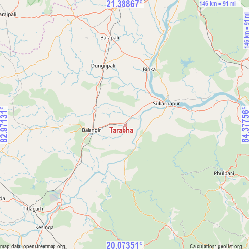
Tarabha GPS coordinates[2]
20° 43' 57.072" North, 83° 40' 27.948" East
| Map corner | latitude | longitude |
|---|---|---|
| Upper-left | 21.38867°, | 82.97131° |
| Center: | 20.73252°, | 83.67443° |
| Lower-right: | 20.07351°, | 84.37756° |
| Map W x H: | 146.2×146.2 km | = 90.8×90.8mi |
| max Lat: | 34.9274° ⇑62.9% North |
| Tarabha: | 20.73252° |
| min Lat: | ⇓37.1% South 8.09008° |
| min Long | Tarabha | max Long |
| 68.82655° | 83.67443° | 96.81° |
| W 81.2%⇐ | ⇒18.8% E |
Elevation
Elevation of Tarabha is 134 m = 440 ft, and this is 161.6 m = 530 ft below average elevation for this country.
| Max E: |
3681 m = 12077 ft | 62.7% |
| Avg. | 295.6 m = 970 ft | |
| Tarabha | 134 m = 440 ft | |
Min E: |
1 m = 3 ft | 37.3% |
See also: India elevation on elevation.city.
Geographical zone
Tarabha is located in North Torrid zone (between Equator and Tropic of Cancer). Distance of this Northern Tropic circle is 300.7 km =186.8 mi to North.| Distance of | km | miles | from Tarabha |
|---|---|---|---|
| North Pole | 7701.8 | 4785.7 | to North |
| Arctic Circle | 5095.9 | 3166.4 | to North |
| Tropic Cancer | 300.7 | 186.8 | to North |
| Equator | 2305.2 | 1432.4 | to South |


Nearby cities:
15 places around Tarabha: (largest is in red/bold)
• Balāngīr
19.4 km =12.1 mi,  260°
260°
• Bargarh
67.1 km =41.7 mi,  355°
355°
• Barpāli
51.7 km =32.1 mi,  349°
349°
• Baud
68.8 km =42.8 mi,  80°
80°
• Binka
35.6 km =22.1 mi,  23°
23°
• Burla
88.8 km =55.2 mi,  13°
13°
• Kaintragarh
89.5 km =55.6 mi,  90°
90°
• Kantābānji
83.8 km =52.1 mi,  249°
249°
• Kesinga
76.9 km =47.8 mi,  218°
218°
• Padampur
70.1 km =43.6 mi,  295°
295°
• Patnāgarh
56.4 km =35 mi,  267°
267°
• Phulbāni
64.3 km =40 mi,  115°
115°
• Sambalpur
87.3 km =54.2 mi, 20°
• Sonepur
27.6 km =17.1 mi,  66°
66°
• Titlāgarh
73.4 km =45.6 mi,  227°
227°
Sources, notices
• [Note1] Compared only with cities in India existing in our database
• [Src1] Map data: © OpenStreetMap contributors (CC-BY-SA)
• [Src2] Other city data from geonames.org with taken over terms of usage.
• [Src3] Geographical zone / Annual Mean Temperature by Robert A. Rohde @ Wikipedia
