Srīnivāspur geodata
Srīnivāspur (Karnataka) is a populated place; located in India in Asia/Kolkata (GMT+5.5) time zone. With population of 25,760 people, there are 1650 cities with bigger population in this country. Compared to other cities in India, 84.8% of cities are located further ↑North; 51.2% of cities are located further ←West and 94.4% of cities have lower elevation than Srīnivāspur. Note1


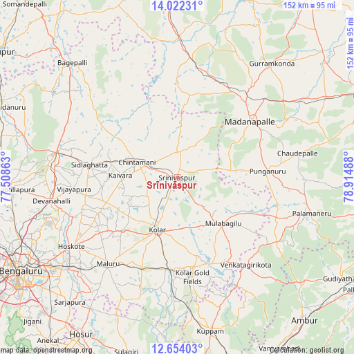
Srīnivāspur GPS coordinates[2]
13° 20' 20.904" North, 78° 12' 42.3" East
| Map corner | latitude | longitude |
|---|---|---|
| Upper-left | 14.02231°, | 77.50863° |
| Center: | 13.33914°, | 78.21175° |
| Lower-right: | 12.65403°, | 78.91488° |
| Map W x H: | 152.1×152.1 km | = 94.5×94.5mi |
| max Lat: | 34.9274° ⇑84.8% North |
| Srīnivāspur: | 13.33914° |
| min Lat: | ⇓15.2% South 8.09008° |
| min Long | Srīnivāspur | max Long |
| 68.82655° | 78.21175° | 96.81° |
| W 51.2%⇐ | ⇒48.8% E |
Elevation
Elevation of Srīnivāspur is 828 m = 2717 ft, and this is 532.4 m = 1747 ft above average elevation for this country.
| Max E: |
3681 m = 12077 ft | 5.6% |
| Srīnivāspur | 828 m 2717 ft | |
| Avg. | 295.6 m = 970 ft | |
Min E: |
1 m = 3 ft | 94.4% |
See also: India elevation on elevation.city.
Geographical zone
Srīnivāspur is located in North Torrid zone (between Equator and Tropic of Cancer). Distance of this Northern Tropic circle is 1122.7 km =697.6 mi to North.| Distance of | km | miles | from Srīnivāspur |
|---|---|---|---|
| North Pole | 8523.9 | 5296.5 | to North |
| Arctic Circle | 5918 | 3677.3 | to North |
| Tropic Cancer | 1122.7 | 697.6 | to North |
| Equator | 1483.2 | 921.6 | to South |


Nearby cities:
15 places around Srīnivāspur: (largest is in red/bold)
• Bangarapet
38.9 km =24.2 mi,  185°
185°
• Chik Ballāpur
53.4 km =33.2 mi,  281°
281°
• Chintāmani
18.6 km =11.6 mi,  291°
291°
• Dasarahalli
49 km =30.4 mi,  236°
236°
• Devanhalli
55.1 km =34.2 mi,  259°
259°
• Hoskote
53.8 km =33.4 mi, 236°
• Kolār
24.1 km =15 mi,  201°
201°
• Madanapalle
39.3 km =24.4 mi,  53°
53°
• Mulbāgal
27.7 km =17.2 mi,  134°
134°
• Mālūr
47.7 km =29.6 mi,  218°
218°
• Palmaner
60 km =37.3 mi,  104°
104°
• Punganūru
39.1 km =24.3 mi,  85°
85°
• Robertsonpet
43.1 km =26.8 mi,  170°
170°
• Sidlaghatta
38 km =23.6 mi, 278°
• Vadigenhalli
44.6 km =27.7 mi, 264°
Sources, notices
• [Note1] Compared only with cities in India existing in our database
• [Src1] Map data: © OpenStreetMap contributors (CC-BY-SA)
• [Src2] Other city data from geonames.org with taken over terms of usage.
• [Src3] Geographical zone / Annual Mean Temperature by Robert A. Rohde @ Wikipedia
