Sidhaulī geodata
Sidhaulī (Uttar Pradesh) is a populated place; located in India in Asia/Kolkata (GMT+5.5) time zone. With population of 22,193 people, there are 1891 cities with bigger population in this country. Compared to other cities in India, 80.6% of cities are located further ↓South; 72.4% of cities are located further ←West and 62.7% of cities have higher elevation than Sidhaulī. Note1


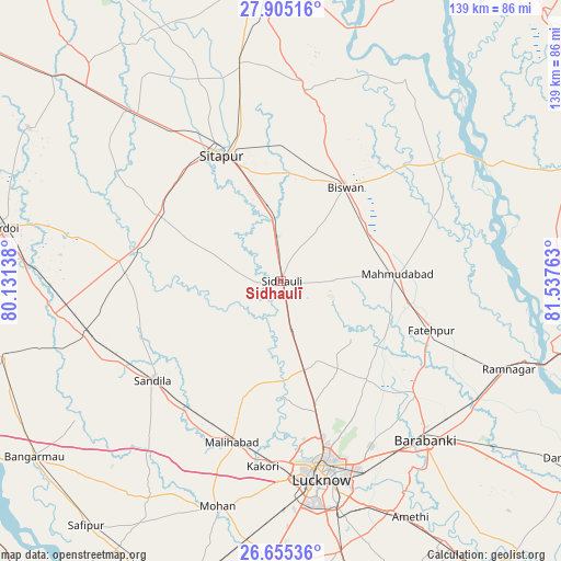
Sidhaulī GPS coordinates[2]
27° 16' 55.272" North, 80° 50' 4.2" East
| Map corner | latitude | longitude |
|---|---|---|
| Upper-left | 27.90516°, | 80.13138° |
| Center: | 27.28202°, | 80.8345° |
| Lower-right: | 26.65536°, | 81.53763° |
| Map W x H: | 139×139 km | = 86.4×86.4mi |
| max Lat: | 34.9274° ⇑19.4% North |
| Sidhaulī: | 27.28202° |
| min Lat: | ⇓80.6% South 8.09008° |
| min Long | Sidhaulī | max Long |
| 68.82655° | 80.8345° | 96.81° |
| W 72.4%⇐ | ⇒27.6% E |
Elevation
Elevation of Sidhaulī is 134 m = 440 ft, and this is 161.6 m = 530 ft below average elevation for this country.
| Max E: |
3681 m = 12077 ft | 62.7% |
| Avg. | 295.6 m = 970 ft | |
| Sidhaulī | 134 m = 440 ft | |
Min E: |
1 m = 3 ft | 37.3% |
See also: India elevation on elevation.city.
Geographical zone
Sidhaulī is located in North temperate zone (between Tropic of Cancer and the Arctic Circle). Distance of this Northern Tropic circle is 427.6 km =265.7 mi to South.| Distance of | km | miles | from Sidhaulī |
|---|---|---|---|
| North Pole | 6973.6 | 4333.2 | to North |
| Arctic Circle | 4367.7 | 2714 | to North |
| Tropic Cancer | 427.6 | 265.7 | to South |
| Equator | 3033.5 | 1884.9 | to South |


Nearby cities:
15 places around Sidhaulī: (largest is in red/bold)
• Aurās
52.1 km =32.4 mi,  218°
218°
• Benīganj
38.6 km =24 mi,  271°
271°
• Biswān
28.6 km =17.8 mi,  33°
33°
• Dewā
42.8 km =26.6 mi,  129°
129°
• Fatehpur
39.1 km =24.3 mi,  108°
108°
• Itaunja
22.9 km =14.2 mi,  164°
164°
• Khairābād
28.4 km =17.6 mi,  343°
343°
• Kākori
46.3 km =28.8 mi,  185°
185°
• Lucknow
50 km =31.1 mi,  169°
169°
• Lāharpur
47.9 km =29.8 mi,  8°
8°
• Mahmudābād
28 km =17.4 mi,  87°
87°
• Malīhābād
41.8 km =26 mi,  197°
197°
• Misrikh
34.2 km =21.3 mi,  299°
299°
• Sandīla
39.4 km =24.5 mi,  233°
233°
• Sītāpur
34.5 km =21.4 mi,  334°
334°
Sources, notices
• [Note1] Compared only with cities in India existing in our database
• [Src1] Map data: © OpenStreetMap contributors (CC-BY-SA)
• [Src2] Other city data from geonames.org with taken over terms of usage.
• [Src3] Geographical zone / Annual Mean Temperature by Robert A. Rohde @ Wikipedia
