Rāmkola geodata
Rāmkola (Uttar Pradesh) is a populated place; located in India in Asia/Kolkata (GMT+5.5) time zone. With population of 13,949 people, there are 2568 cities with bigger population in this country. Compared to other cities in India, 77.7% of cities are located further ↓South; 81.5% of cities are located further ←West and 70.5% of cities have higher elevation than Rāmkola. Note1


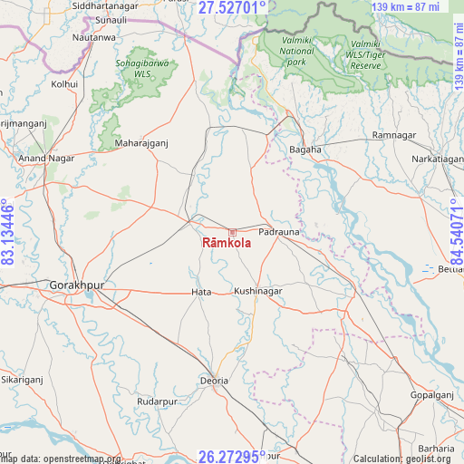
Rāmkola GPS coordinates[2]
26° 54' 6.192" North, 83° 50' 15.288" East
| Map corner | latitude | longitude |
|---|---|---|
| Upper-left | 27.52701°, | 83.13446° |
| Center: | 26.90172°, | 83.83758° |
| Lower-right: | 26.27295°, | 84.54071° |
| Map W x H: | 139.4×139.4 km | = 86.6×86.6mi |
| max Lat: | 34.9274° ⇑22.3% North |
| Rāmkola: | 26.90172° |
| min Lat: | ⇓77.7% South 8.09008° |
| min Long | Rāmkola | max Long |
| 68.82655° | 83.83758° | 96.81° |
| W 81.5%⇐ | ⇒18.5% E |
Elevation
Elevation of Rāmkola is 90 m = 295 ft, and this is 205.6 m = 675 ft below average elevation for this country.
| Max E: |
3681 m = 12077 ft | 70.5% |
| Avg. | 295.6 m = 970 ft | |
| Rāmkola | 90 m = 295 ft | |
Min E: |
1 m = 3 ft | 29.5% |
See also: India elevation on elevation.city.
Geographical zone
Rāmkola is located in North temperate zone (between Tropic of Cancer and the Arctic Circle). Distance of this Northern Tropic circle is 385.3 km =239.4 mi to South.| Distance of | km | miles | from Rāmkola |
|---|---|---|---|
| North Pole | 7015.9 | 4359.5 | to North |
| Arctic Circle | 4410 | 2740.2 | to North |
| Tropic Cancer | 385.3 | 239.4 | to South |
| Equator | 2991.2 | 1858.6 | to South |


Nearby cities:
15 places around Rāmkola: (largest is in red/bold)
• Anandnagar
60.3 km =37.5 mi,  291°
291°
• Bagaha
33.3 km =20.7 mi,  48°
48°
• Bānsgāon
62.6 km =38.9 mi,  231°
231°
• Captainganj
12.6 km =7.8 mi,  282°
282°
• Deoria
44.9 km =27.9 mi,  187°
187°
• Gorakhpur
48.9 km =30.4 mi,  252°
252°
• Hātā
20.1 km =12.5 mi,  207°
207°
• Khada
31.6 km =19.6 mi,  8°
8°
• Mahārāganj
38.4 km =23.9 mi,  314°
314°
• Nichlaul
47 km =29.2 mi,  346°
346°
• Padrauna
14.2 km =8.8 mi,  88°
88°
• Pipraich
32 km =19.9 mi,  255°
255°
• Rāmnagar
56.2 km =34.9 mi,  58°
58°
• Rūdarpur
55.5 km =34.5 mi,  203°
203°
• Siswā Bāzār
28.3 km =17.6 mi,  343°
343°
Sources, notices
• [Note1] Compared only with cities in India existing in our database
• [Src1] Map data: © OpenStreetMap contributors (CC-BY-SA)
• [Src2] Other city data from geonames.org with taken over terms of usage.
• [Src3] Geographical zone / Annual Mean Temperature by Robert A. Rohde @ Wikipedia
