Siswā Bāzār geodata
Siswā Bāzār (Uttar Pradesh) is a populated place; located in India in Asia/Kolkata (GMT+5.5) time zone. With population of 19,939 people, there are 2049 cities with bigger population in this country. Compared to other cities in India, 79.6% of cities are located further ↓South; 81.4% of cities are located further ←West and 68.5% of cities have higher elevation than Siswā Bāzār. Note1


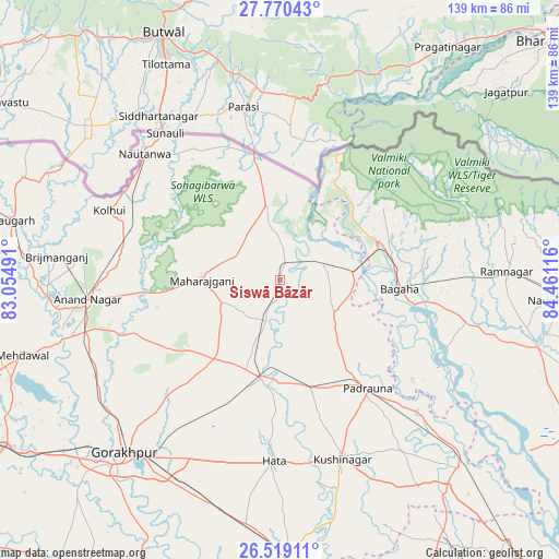
Siswā Bāzār GPS coordinates[2]
27° 8' 47.472" North, 83° 45' 28.908" East
| Map corner | latitude | longitude |
|---|---|---|
| Upper-left | 27.77043°, | 83.05491° |
| Center: | 27.14652°, | 83.75803° |
| Lower-right: | 26.51911°, | 84.46116° |
| Map W x H: | 139.1×139.1 km | = 86.4×86.4mi |
| max Lat: | 34.9274° ⇑20.4% North |
| Siswā Bāzār: | 27.14652° |
| min Lat: | ⇓79.6% South 8.09008° |
| min Long | Siswā Bāzār | max Long |
| 68.82655° | 83.75803° | 96.81° |
| W 81.4%⇐ | ⇒18.6% E |
Elevation
Elevation of Siswā Bāzār is 100 m = 328 ft, and this is 195.6 m = 642 ft below average elevation for this country.
| Max E: |
3681 m = 12077 ft | 68.5% |
| Avg. | 295.6 m = 970 ft | |
| Siswā Bāzār | 100 m = 328 ft | |
Min E: |
1 m = 3 ft | 31.5% |
See also: India elevation on elevation.city.
Geographical zone
Siswā Bāzār is located in North temperate zone (between Tropic of Cancer and the Arctic Circle). Distance of this Northern Tropic circle is 412.5 km =256.3 mi to South.| Distance of | km | miles | from Siswā Bāzār |
|---|---|---|---|
| North Pole | 6988.7 | 4342.6 | to North |
| Arctic Circle | 4382.8 | 2723.3 | to North |
| Tropic Cancer | 412.5 | 256.3 | to South |
| Equator | 3018.4 | 1875.5 | to South |


Nearby cities:
15 places around Siswā Bāzār: (largest is in red/bold)
• Anandnagar
48.4 km =30.1 mi,  263°
263°
• Bagaha
33.3 km =20.7 mi,  99°
99°
• Captainganj
24.9 km =15.5 mi,  190°
190°
• Deoria
71.7 km =44.6 mi,  178°
178°
• Gorakhpur
57.2 km =35.5 mi,  222°
222°
• Hātā
45.1 km =28 mi, 181°
• Khada
13.1 km =8.1 mi,  71°
71°
• Mahārāganj
19.4 km =12.1 mi,  269°
269°
• Mehndāwal
66.9 km =41.6 mi,  253°
253°
• Nautanwa
45.9 km =28.5 mi,  312°
312°
• Nichlaul
18.7 km =11.6 mi,  350°
350°
• Padrauna
34.8 km =21.6 mi,  140°
140°
• Pipraich
42.3 km =26.3 mi,  212°
212°
• Rāmkola
28.3 km =17.6 mi,  163°
163°
• Rāmnagar
56 km =34.8 mi,  88°
88°
Sources, notices
• [Note1] Compared only with cities in India existing in our database
• [Src1] Map data: © OpenStreetMap contributors (CC-BY-SA)
• [Src2] Other city data from geonames.org with taken over terms of usage.
• [Src3] Geographical zone / Annual Mean Temperature by Robert A. Rohde @ Wikipedia
