Padrauna geodata
Padrauna (Uttar Pradesh) is a populated place; located in India in Asia/Kolkata (GMT+5.5) time zone. With population of 47,181 people, there are 936 cities with bigger population in this country. Compared to other cities in India, 77.7% of cities are located further ↓South; 81.9% of cities are located further ←West and 69.7% of cities have higher elevation than Padrauna. Note1


Padrauna GPS coordinates[2]
26° 54' 14.508" North, 83° 58' 51.132" East
| Map corner | latitude | longitude |
|---|---|---|
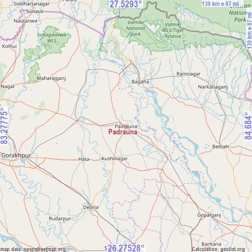
| Upper-left | 27.5293°, | 83.27775° |
| Center: | 26.90403°, | 83.98087° |
| Lower-right: | 26.27528°, | 84.684° |
| Map W x H: | 139.4×139.4 km | = 86.6×86.6mi |
| max Lat: | 34.9274° ⇑22.3% North |
| Padrauna: | 26.90403° |
| min Lat: | ⇓77.7% South 8.09008° |
| min Long | Padrauna | max Long |
| 68.82655° | 83.98087° | 96.81° |
| W 81.9%⇐ | ⇒18.1% E |
Elevation
Elevation of Padrauna is 94 m = 308 ft, and this is 201.6 m = 661 ft below average elevation for this country.
| Max E: |
3681 m = 12077 ft | 69.7% |
| Avg. | 295.6 m = 970 ft | |
| Padrauna | 94 m = 308 ft | |
Min E: |
1 m = 3 ft | 30.3% |
See also: Padrauna elevation on elevation.city.
Geographical zone
Padrauna is located in North temperate zone (between Tropic of Cancer and the Arctic Circle). Distance of this Northern Tropic circle is 385.5 km =239.5 mi to South.| Distance of | km | miles | from Padrauna |
|---|---|---|---|
| North Pole | 7015.6 | 4359.3 | to North |
| Arctic Circle | 4409.7 | 2740.1 | to North |
| Tropic Cancer | 385.5 | 239.5 | to South |
| Equator | 2991.4 | 1858.8 | to South |


Nearby cities:
15 places around Padrauna: (largest is in red/bold)
• Bagaha
24.2 km =15 mi,  26°
26°
• Bettiah
53 km =32.9 mi,  102°
102°
• Captainganj
26.6 km =16.5 mi,  275°
275°
• Deoria
49 km =30.4 mi,  204°
204°
• Gopālganj
66.6 km =41.4 mi,  136°
136°
• Gorakhpur
62.6 km =38.9 mi,  255°
255°
• Hātā
29.6 km =18.4 mi,  232°
232°
• Khada
32.5 km =20.2 mi,  342°
342°
• Mahārāganj
49.4 km =30.7 mi,  302°
302°
• Nichlaul
52 km =32.3 mi,  330°
330°
• Pipraich
45.9 km =28.5 mi, 259°
• Rāmkola
14.2 km =8.8 mi,  268°
268°
• Rāmnagar
44.5 km =27.7 mi,  49°
49°
• Rūdarpur
62.8 km =39 mi,  215°
215°
• Siswā Bāzār
34.8 km =21.6 mi,  320°
320°
Sources, notices
• [Note1] Compared only with cities in India existing in our database
• [Src1] Map data: © OpenStreetMap contributors (CC-BY-SA)
• [Src2] Other city data from geonames.org with taken over terms of usage.
• [Src3] Geographical zone / Annual Mean Temperature by Robert A. Rohde @ Wikipedia
