Rāmnagar geodata
Rāmnagar (Bihar) is a populated place; located in India in Asia/Kolkata (GMT+5.5) time zone. With population of 43,497 people, there are 1016 cities with bigger population in this country. Compared to other cities in India, 79.7% of cities are located further ↓South; 82.6% of cities are located further ←West and 68.5% of cities have higher elevation than Rāmnagar. Note1


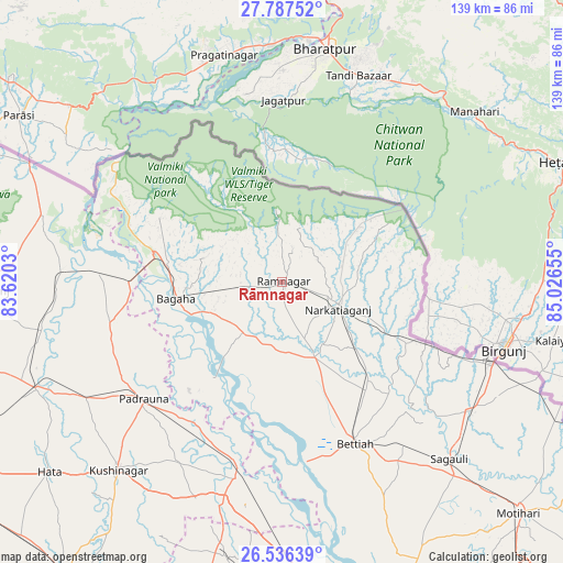
Rāmnagar GPS coordinates[2]
27° 9' 49.356" North, 84° 19' 24.312" East
| Map corner | latitude | longitude |
|---|---|---|
| Upper-left | 27.78752°, | 83.6203° |
| Center: | 27.16371°, | 84.32342° |
| Lower-right: | 26.53639°, | 85.02655° |
| Map W x H: | 139.1×139.1 km | = 86.4×86.4mi |
| max Lat: | 34.9274° ⇑20.3% North |
| Rāmnagar: | 27.16371° |
| min Lat: | ⇓79.7% South 8.09008° |
| min Long | Rāmnagar | max Long |
| 68.82655° | 84.32342° | 96.81° |
| W 82.6%⇐ | ⇒17.4% E |
Elevation
Elevation of Rāmnagar is 100 m = 328 ft, and this is 195.6 m = 642 ft below average elevation for this country.
| Max E: |
3681 m = 12077 ft | 68.5% |
| Avg. | 295.6 m = 970 ft | |
| Rāmnagar | 100 m = 328 ft | |
Min E: |
1 m = 3 ft | 31.5% |
See also: Rāmnagar elevation on elevation.city.
Geographical zone
Rāmnagar is located in North temperate zone (between Tropic of Cancer and the Arctic Circle). Distance of this Northern Tropic circle is 414.4 km =257.5 mi to South.| Distance of | km | miles | from Rāmnagar |
|---|---|---|---|
| North Pole | 6986.7 | 4341.3 | to North |
| Arctic Circle | 4380.9 | 2722.2 | to North |
| Tropic Cancer | 414.4 | 257.5 | to South |
| Equator | 3020.3 | 1876.7 | to South |


Nearby cities:
15 places around Rāmnagar: (largest is in red/bold)
• Bagaha
24.2 km =15 mi,  252°
252°
• Bettiah
44 km =27.3 mi,  156°
156°
• Captainganj
65.9 km =40.9 mi, 246°
• Gopālganj
78.3 km =48.7 mi,  171°
171°
• Hātā
74.1 km =46 mi,  230°
230°
• Khada
43.6 km =27.1 mi,  272°
272°
• Mahārāganj
75.3 km =46.8 mi, 268°
• Mothīhāri
82.1 km =51 mi,  134°
134°
• Nichlaul
61.4 km =38.2 mi,  285°
285°
• Padrauna
44.5 km =27.7 mi, 229°
• Pipraich
87.4 km =54.3 mi,  244°
244°
• Raxaul
56.1 km =34.9 mi,  111°
111°
• Rāmkola
56.2 km =34.9 mi, 238°
• Sagauli
60.9 km =37.8 mi,  136°
136°
• Siswā Bāzār
56 km =34.8 mi, 268°
Sources, notices
• [Note1] Compared only with cities in India existing in our database
• [Src1] Map data: © OpenStreetMap contributors (CC-BY-SA)
• [Src2] Other city data from geonames.org with taken over terms of usage.
• [Src3] Geographical zone / Annual Mean Temperature by Robert A. Rohde @ Wikipedia
