Khada geodata
Khada (Uttar Pradesh) is a populated place; located in India in Asia/Kolkata (GMT+5.5) time zone. With population of 16,350 people, there are 2343 cities with bigger population in this country. Compared to other cities in India, 80% of cities are located further ↓South; 81.7% of cities are located further ←West and 69.3% of cities have higher elevation than Khada. Note1


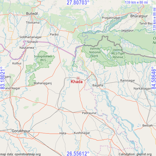
Khada GPS coordinates[2]
27° 10' 59.988" North, 83° 52' 59.988" East
| Map corner | latitude | longitude |
|---|---|---|
| Upper-left | 27.80703°, | 83.18021° |
| Center: | 27.18333°, | 83.88333° |
| Lower-right: | 26.55612°, | 84.58646° |
| Map W x H: | 139.1×139.1 km | = 86.4×86.4mi |
| max Lat: | 34.9274° ⇑20% North |
| Khada: | 27.18333° |
| min Lat: | ⇓80% South 8.09008° |
| min Long | Khada | max Long |
| 68.82655° | 83.88333° | 96.81° |
| W 81.7%⇐ | ⇒18.3% E |
Elevation
Elevation of Khada is 96 m = 315 ft, and this is 199.6 m = 655 ft below average elevation for this country.
| Max E: |
3681 m = 12077 ft | 69.3% |
| Avg. | 295.6 m = 970 ft | |
| Khada | 96 m = 315 ft | |
Min E: |
1 m = 3 ft | 30.7% |
See also: India elevation on elevation.city.
Geographical zone
Khada is located in North temperate zone (between Tropic of Cancer and the Arctic Circle). Distance of this Northern Tropic circle is 416.6 km =258.9 mi to South.| Distance of | km | miles | from Khada |
|---|---|---|---|
| North Pole | 6984.6 | 4340 | to North |
| Arctic Circle | 4378.7 | 2720.8 | to North |
| Tropic Cancer | 416.6 | 258.9 | to South |
| Equator | 3022.5 | 1878.1 | to South |


Nearby cities:
15 places around Khada: (largest is in red/bold)
• Anandnagar
61.2 km =38 mi,  261°
261°
• Bagaha
22.5 km =14 mi,  114°
114°
• Bettiah
74.6 km =46.4 mi,  124°
124°
• Captainganj
33.2 km =20.6 mi,  210°
210°
• Deoria
76.5 km =47.5 mi,  187°
187°
• Gorakhpur
68.9 km =42.8 mi,  227°
227°
• Hātā
51 km =31.7 mi,  195°
195°
• Mahārāganj
32.1 km =19.9 mi, 262°
• Nautanwa
53.4 km =33.2 mi,  300°
300°
• Nichlaul
21.2 km =13.2 mi,  312°
312°
• Padrauna
32.5 km =20.2 mi,  162°
162°
• Pipraich
53.1 km =33 mi,  221°
221°
• Rāmkola
31.6 km =19.6 mi, 188°
• Rāmnagar
43.6 km =27.1 mi,  92°
92°
• Siswā Bāzār
13.1 km =8.1 mi,  251°
251°
Sources, notices
• [Note1] Compared only with cities in India existing in our database
• [Src1] Map data: © OpenStreetMap contributors (CC-BY-SA)
• [Src2] Other city data from geonames.org with taken over terms of usage.
• [Src3] Geographical zone / Annual Mean Temperature by Robert A. Rohde @ Wikipedia
