Rāmānuj Ganj geodata
Rāmānuj Ganj (Chhattisgarh) is a populated place; located in India in Asia/Kolkata (GMT+5.5) time zone. With population of 10,701 people, there are 2869 cities with bigger population in this country. Compared to other cities in India, 56.9% of cities are located further ↓South; 81.2% of cities are located further ←West and 78.4% of cities have lower elevation than Rāmānuj Ganj. Note1


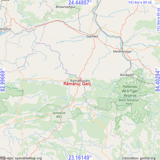
Rāmānuj Ganj GPS coordinates[2]
23° 48' 22.932" North, 83° 41' 59.316" East
| Map corner | latitude | longitude |
|---|---|---|
| Upper-left | 24.44807°, | 82.99669° |
| Center: | 23.80637°, | 83.69981° |
| Lower-right: | 23.16149°, | 84.40294° |
| Map W x H: | 143.1×143.1 km | = 88.9×88.9mi |
| max Lat: | 34.9274° ⇑43.1% North |
| Rāmānuj Ganj: | 23.80637° |
| min Lat: | ⇓56.9% South 8.09008° |
| min Long | Rāmānuj Ganj | max Long |
| 68.82655° | 83.69981° | 96.81° |
| W 81.2%⇐ | ⇒18.8% E |
Elevation
Elevation of Rāmānuj Ganj is 436 m = 1430 ft, and this is 140.4 m = 461 ft above average elevation for this country.
| Max E: |
3681 m = 12077 ft | 21.6% |
| Rāmānuj Ganj | 436 m 1430 ft | |
| Avg. | 295.6 m = 970 ft | |
Min E: |
1 m = 3 ft | 78.4% |
See also: India elevation on elevation.city.
Geographical zone
Rāmānuj Ganj is located in North temperate zone (between Tropic of Cancer and the Arctic Circle). Distance of this Northern Tropic circle is 41.1 km =25.5 mi to South.| Distance of | km | miles | from Rāmānuj Ganj |
|---|---|---|---|
| North Pole | 7360 | 4573.3 | to North |
| Arctic Circle | 4754.2 | 2954.1 | to North |
| Tropic Cancer | 41.1 | 25.5 | to South |
| Equator | 2647 | 1644.8 | to South |


Nearby cities:
15 places around Rāmānuj Ganj: (largest is in red/bold)
• Ambikāpur
92.1 km =57.2 mi,  213°
213°
• Balrampur
23.4 km =14.5 mi,  202°
202°
• Barwādih
42 km =26.1 mi,  83°
83°
• Chopan
104.9 km =65.2 mi,  319°
319°
• Daltonganj
45.4 km =28.2 mi,  55°
55°
• Dūdhi
65 km =40.4 mi,  314°
314°
• Garhwa
40.8 km =25.4 mi,  15°
15°
• Husainābād
85.9 km =53.4 mi, 20°
• Kota
91.7 km =57 mi, 320°
• Lātehār
81.7 km =50.8 mi,  94°
94°
• Nabīnagar
99 km =61.5 mi,  25°
25°
• Neturhāt
68.6 km =42.6 mi,  122°
122°
• Obra
99.3 km =61.7 mi, 313°
• Renukūt
81.4 km =50.6 mi,  304°
304°
• Surajpur
107.4 km =66.7 mi,  232°
232°
Sources, notices
• [Note1] Compared only with cities in India existing in our database
• [Src1] Map data: © OpenStreetMap contributors (CC-BY-SA)
• [Src2] Other city data from geonames.org with taken over terms of usage.
• [Src3] Geographical zone / Annual Mean Temperature by Robert A. Rohde @ Wikipedia
