Neturhāt geodata
Neturhāt (Jharkhand) is a populated place; located in India in Asia/Kolkata (GMT+5.5) time zone. With population of 4,424 people, there are 3363 cities with bigger population in this country. Compared to other cities in India, 54.7% of cities are located further ↓South; 82.6% of cities are located further ←West and 96.6% of cities have lower elevation than Neturhāt. Note1


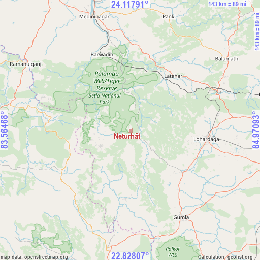
Neturhāt GPS coordinates[2]
23° 28' 28.452" North, 84° 16' 4.08" East
| Map corner | latitude | longitude |
|---|---|---|
| Upper-left | 24.11791°, | 83.56468° |
| Center: | 23.47457°, | 84.2678° |
| Lower-right: | 22.82807°, | 84.97093° |
| Map W x H: | 143.4×143.4 km | = 89.1×89.1mi |
| max Lat: | 34.9274° ⇑45.3% North |
| Neturhāt: | 23.47457° |
| min Lat: | ⇓54.7% South 8.09008° |
| min Long | Neturhāt | max Long |
| 68.82655° | 84.2678° | 96.81° |
| W 82.6%⇐ | ⇒17.4% E |
Elevation
Elevation of Neturhāt is 1086 m = 3563 ft, and this is 790.4 m = 2593 ft above average elevation for this country.
| Max E: |
3681 m = 12077 ft | 3.4% |
| Neturhāt | 1086 m 3563 ft | |
| Avg. | 295.6 m = 970 ft | |
Min E: |
1 m = 3 ft | 96.6% |
See also: India elevation on elevation.city.
Geographical zone
Neturhāt is located in North temperate zone (between Tropic of Cancer and the Arctic Circle). Distance of this Northern Tropic circle is 4.2 km =2.6 mi to South.| Distance of | km | miles | from Neturhāt |
|---|---|---|---|
| North Pole | 7396.9 | 4596.2 | to North |
| Arctic Circle | 4791 | 2977 | to North |
| Tropic Cancer | 4.2 | 2.6 | to South |
| Equator | 2610.1 | 1621.8 | to South |


Nearby cities:
15 places around Neturhāt: (largest is in red/bold)
• Balrampur
68.7 km =42.7 mi,  282°
282°
• Barwādih
44.5 km =27.7 mi,  338°
338°
• Chatrā
101.9 km =63.3 mi,  37°
37°
• Daltonganj
66.1 km =41.1 mi, 341°
• Garhwa
89.4 km =55.6 mi,  328°
328°
• Gumlā
55.7 km =34.6 mi,  149°
149°
• Jashpurnagar
66.6 km =41.4 mi,  191°
191°
• Khunti
112.3 km =69.8 mi,  113°
113°
• Kānke
107.5 km =66.8 mi,  92°
92°
• Lohārdagā
42.3 km =26.3 mi,  96°
96°
• Lātehār
38.2 km =23.7 mi, 38°
• Ranchi
107.3 km =66.7 mi, 97°
• Rāmānuj Ganj
68.6 km =42.6 mi,  302°
302°
• Rāy
83.5 km =51.9 mi,  73°
73°
• Simdega
98.5 km =61.2 mi,  165°
165°
Sources, notices
• [Note1] Compared only with cities in India existing in our database
• [Src1] Map data: © OpenStreetMap contributors (CC-BY-SA)
• [Src2] Other city data from geonames.org with taken over terms of usage.
• [Src3] Geographical zone / Annual Mean Temperature by Robert A. Rohde @ Wikipedia
