Nabīnagar geodata
Nabīnagar (Bihar) is a populated place; located in India in Asia/Kolkata (GMT+5.5) time zone. With population of 20,848 people, there are 1974 cities with bigger population in this country. Compared to other cities in India, 61.3% of cities are located further ↓South; 82.3% of cities are located further ←West and 60.8% of cities have higher elevation than Nabīnagar. Note1


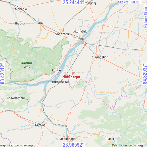
Nabīnagar GPS coordinates[2]
24° 36' 24.516" North, 84° 7' 34.464" East
| Map corner | latitude | longitude |
|---|---|---|
| Upper-left | 25.24444°, | 83.42312° |
| Center: | 24.60681°, | 84.12624° |
| Lower-right: | 23.96592°, | 84.82937° |
| Map W x H: | 142.2×142.2 km | = 88.4×88.4mi |
| max Lat: | 34.9274° ⇑38.7% North |
| Nabīnagar: | 24.60681° |
| min Lat: | ⇓61.3% South 8.09008° |
| min Long | Nabīnagar | max Long |
| 68.82655° | 84.12624° | 96.81° |
| W 82.3%⇐ | ⇒17.7% E |
Elevation
Elevation of Nabīnagar is 144 m = 472 ft, and this is 151.6 m = 497 ft below average elevation for this country.
| Max E: |
3681 m = 12077 ft | 60.8% |
| Avg. | 295.6 m = 970 ft | |
| Nabīnagar | 144 m = 472 ft | |
Min E: |
1 m = 3 ft | 39.2% |
See also: India elevation on elevation.city.
Geographical zone
Nabīnagar is located in North temperate zone (between Tropic of Cancer and the Arctic Circle). Distance of this Northern Tropic circle is 130.1 km =80.8 mi to South.| Distance of | km | miles | from Nabīnagar |
|---|---|---|---|
| North Pole | 7271 | 4518 | to North |
| Arctic Circle | 4665.2 | 2898.8 | to North |
| Tropic Cancer | 130.1 | 80.8 | to South |
| Equator | 2736 | 1700.1 | to South |


Nearby cities:
15 places around Nabīnagar: (largest is in red/bold)
• Aurangābād
29.8 km =18.5 mi,  57°
57°
• Barwādih
84.4 km =52.4 mi,  181°
181°
• Bhabhua
71.2 km =44.2 mi,  312°
312°
• Bikramganj
68.4 km =42.5 mi,  10°
10°
• Daltonganj
63.4 km =39.4 mi,  185°
185°
• Daudnagar
55.1 km =34.2 mi,  30°
30°
• Dehri
33.4 km =20.8 mi, 9°
• Garhwa
59.2 km =36.8 mi,  213°
213°
• Husainābād
15.5 km =9.6 mi,  235°
235°
• Koāth
81.1 km =50.4 mi, 9°
• Nāsriganj
53.5 km =33.2 mi,  22°
22°
• Piro
85.4 km =53.1 mi, 19°
• Rafiganj
56.4 km =35 mi,  65°
65°
• Sherghāti
67.5 km =41.9 mi,  94°
94°
• Tekāri
81.4 km =50.6 mi, 62°
Sources, notices
• [Note1] Compared only with cities in India existing in our database
• [Src1] Map data: © OpenStreetMap contributors (CC-BY-SA)
• [Src2] Other city data from geonames.org with taken over terms of usage.
• [Src3] Geographical zone / Annual Mean Temperature by Robert A. Rohde @ Wikipedia
