Rāhatgarh geodata
Rāhatgarh (Madhya Pradesh) is a populated place; located in India in Asia/Kolkata (GMT+5.5) time zone. With population of 27,462 people, there are 1568 cities with bigger population in this country. Compared to other cities in India, 56.8% of cities are located further ↓South; 53% of cities are located further ←West and 81.1% of cities have lower elevation than Rāhatgarh. Note1


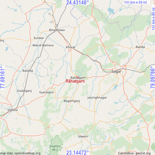
Rāhatgarh GPS coordinates[2]
23° 47' 22.848" North, 78° 23' 41.028" East
| Map corner | latitude | longitude |
|---|---|---|
| Upper-left | 24.43146°, | 77.69161° |
| Center: | 23.78968°, | 78.39473° |
| Lower-right: | 23.14472°, | 79.09786° |
| Map W x H: | 143.1×143.1 km | = 88.9×88.9mi |
| max Lat: | 34.9274° ⇑43.2% North |
| Rāhatgarh: | 23.78968° |
| min Lat: | ⇓56.8% South 8.09008° |
| min Long | Rāhatgarh | max Long |
| 68.82655° | 78.39473° | 96.81° |
| W 53%⇐ | ⇒47% E |
Elevation
Elevation of Rāhatgarh is 474 m = 1555 ft, and this is 178.4 m = 585 ft above average elevation for this country.
| Max E: |
3681 m = 12077 ft | 18.9% |
| Rāhatgarh | 474 m 1555 ft | |
| Avg. | 295.6 m = 970 ft | |
Min E: |
1 m = 3 ft | 81.1% |
See also: India elevation on elevation.city.
Geographical zone
Rāhatgarh is located in North temperate zone (between Tropic of Cancer and the Arctic Circle). Distance of this Northern Tropic circle is 39.2 km =24.4 mi to South.| Distance of | km | miles | from Rāhatgarh |
|---|---|---|---|
| North Pole | 7361.9 | 4574.5 | to North |
| Arctic Circle | 4756 | 2955.2 | to North |
| Tropic Cancer | 39.2 | 24.4 | to South |
| Equator | 2645.2 | 1643.7 | to South |


Nearby cities:
15 places around Rāhatgarh: (largest is in red/bold)
• Bamora
42.9 km =26.7 mi,  313°
313°
• Banda
64.2 km =39.9 mi,  63°
63°
• Begamganj
21.9 km =13.6 mi,  194°
194°
• Bāsoda
47.1 km =29.3 mi,  278°
278°
• Dhāna
47.8 km =29.7 mi,  95°
95°
• Etāwa
47.9 km =29.8 mi,  336°
336°
• Jaithāri
68.4 km =42.5 mi,  160°
160°
• Karrāpur
51.1 km =31.8 mi,  69°
69°
• Khurai
29 km =18 mi,  346°
346°
• Korwai
51.3 km =31.9 mi,  315°
315°
• Rehli
70.1 km =43.6 mi, 103°
• Saugor
35.4 km =22 mi,  81°
81°
• Shāhpur
67.7 km =42.1 mi, 80°
• Sānchi
74.9 km =46.5 mi,  243°
243°
• Vidisha
66.3 km =41.2 mi, 243°
Sources, notices
• [Note1] Compared only with cities in India existing in our database
• [Src1] Map data: © OpenStreetMap contributors (CC-BY-SA)
• [Src2] Other city data from geonames.org with taken over terms of usage.
• [Src3] Geographical zone / Annual Mean Temperature by Robert A. Rohde @ Wikipedia
