Perūr geodata
Perūr (Tamil Nadu) is a populated place; located in India in Asia/Kolkata (GMT+5.5) time zone. With population of 8,341 people, there are 3093 cities with bigger population in this country. Compared to other cities in India, 93.3% of cities are located further ↑North; 64.3% of cities are located further →East and 77.4% of cities have lower elevation than Perūr. Note1


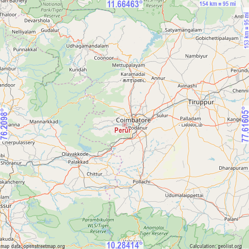
Perūr GPS coordinates[2]
10° 58' 30.684" North, 76° 54' 46.512" East
| Map corner | latitude | longitude |
|---|---|---|
| Upper-left | 11.66463°, | 76.2098° |
| Center: | 10.97519°, | 76.91292° |
| Lower-right: | 10.28414°, | 77.61605° |
| Map W x H: | 153.5×153.5 km | = 95.4×95.4mi |
| max Lat: | 34.9274° ⇑93.3% North |
| Perūr: | 10.97519° |
| min Lat: | ⇓6.7% South 8.09008° |
| min Long | Perūr | max Long |
| 68.82655° | 76.91292° | 96.81° |
| W 35.7%⇐ | ⇒64.3% E |
Elevation
Elevation of Perūr is 421 m = 1381 ft, and this is 125.4 m = 411 ft above average elevation for this country.
| Max E: |
3681 m = 12077 ft | 22.6% |
| Perūr | 421 m 1381 ft | |
| Avg. | 295.6 m = 970 ft | |
Min E: |
1 m = 3 ft | 77.4% |
See also: India elevation on elevation.city.
Geographical zone
Perūr is located in North Torrid zone (between Equator and Tropic of Cancer). Distance of Equator is 1220.3 km =758.3 mi to South.| Distance of | km | miles | from Perūr |
|---|---|---|---|
| North Pole | 8786.7 | 5459.8 | to North |
| Arctic Circle | 6180.8 | 3840.6 | to North |
| Tropic Cancer | 1385.6 | 861 | to North |
| Equator | 1220.3 | 758.3 | to South |


Nearby cities:
15 places around Perūr: (largest is in red/bold)
• Annur
35.8 km =22.2 mi,  35°
35°
• Chettipālaiyam
15.2 km =9.4 mi,  117°
117°
• Chittūr
35.6 km =22.1 mi,  210°
210°
• Coimbatore
6.7 km =4.2 mi,  59°
59°
• Irugūr
17 km =10.6 mi,  73°
73°
• Kāramadai
30 km =18.6 mi,  9°
9°
• Madukkarai
9.5 km =5.9 mi,  144°
144°
• Mettupalayam
36.2 km =22.5 mi,  3°
3°
• Periyanayakkanpalaiyam
20.2 km =12.6 mi, 12°
• Periyanegamam
33.1 km =20.6 mi, 141°
• Pollachi
36.8 km =22.9 mi,  163°
163°
• Pālghāt
36.1 km =22.4 mi,  231°
231°
• Singānallūr
13.3 km =8.3 mi,  78°
78°
• Sirumugai
39.8 km =24.7 mi, 14°
• Sulur
23.9 km =14.9 mi, 76°
Sources, notices
• [Note1] Compared only with cities in India existing in our database
• [Src1] Map data: © OpenStreetMap contributors (CC-BY-SA)
• [Src2] Other city data from geonames.org with taken over terms of usage.
• [Src3] Geographical zone / Annual Mean Temperature by Robert A. Rohde @ Wikipedia
