Irugūr geodata
Irugūr (Tamil Nadu) is a populated place; located in India in Asia/Kolkata (GMT+5.5) time zone. With population of 19,166 people, there are 2110 cities with bigger population in this country. Compared to other cities in India, 93% of cities are located further ↑North; 62.3% of cities are located further →East and 74.8% of cities have lower elevation than Irugūr. Note1


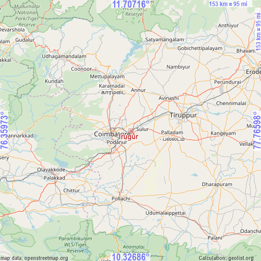
Irugūr GPS coordinates[2]
11° 1' 4.152" North, 77° 3' 46.26" East
| Map corner | latitude | longitude |
|---|---|---|
| Upper-left | 11.70716°, | 76.35973° |
| Center: | 11.01782°, | 77.06285° |
| Lower-right: | 10.32686°, | 77.76598° |
| Map W x H: | 153.5×153.5 km | = 95.4×95.4mi |
| max Lat: | 34.9274° ⇑93% North |
| Irugūr: | 11.01782° |
| min Lat: | ⇓7% South 8.09008° |
| min Long | Irugūr | max Long |
| 68.82655° | 77.06285° | 96.81° |
| W 37.7%⇐ | ⇒62.3% E |
Elevation
Elevation of Irugūr is 382 m = 1253 ft, and this is 86.4 m = 283 ft above average elevation for this country.
| Max E: |
3681 m = 12077 ft | 25.2% |
| Irugūr | 382 m 1253 ft | |
| Avg. | 295.6 m = 970 ft | |
Min E: |
1 m = 3 ft | 74.8% |
See also: India elevation on elevation.city.
Geographical zone
Irugūr is located in North Torrid zone (between Equator and Tropic of Cancer). Distance of Equator is 1225.1 km =761.2 mi to South.| Distance of | km | miles | from Irugūr |
|---|---|---|---|
| North Pole | 8782 | 5456.9 | to North |
| Arctic Circle | 6176.1 | 3837.6 | to North |
| Tropic Cancer | 1380.9 | 858.1 | to North |
| Equator | 1225.1 | 761.2 | to South |


Nearby cities:
15 places around Irugūr: (largest is in red/bold)
• Annur
24.7 km =15.3 mi,  10°
10°
• Avinashi
29.7 km =18.5 mi,  49°
49°
• Chettipālaiyam
12 km =7.5 mi,  193°
193°
• Coimbatore
10.6 km =6.6 mi,  262°
262°
• Kāramadai
27.2 km =16.9 mi,  335°
335°
• Madukkarai
16.5 km =10.3 mi,  221°
221°
• Mettupalayam
34.3 km =21.3 mi, 335°
• Palladam
24.6 km =15.3 mi,  96°
96°
• Periyanayakkanpalaiyam
19.3 km =12 mi,  320°
320°
• Periyanegamam
30.9 km =19.2 mi,  171°
171°
• Perūr
17 km =10.6 mi,  253°
253°
• Singānallūr
3.9 km =2.4 mi,  237°
237°
• Sirumugai
34.3 km =21.3 mi,  349°
349°
• Sulur
6.9 km =4.3 mi,  84°
84°
• Tiruppur
33.6 km =20.9 mi,  71°
71°
Sources, notices
• [Note1] Compared only with cities in India existing in our database
• [Src1] Map data: © OpenStreetMap contributors (CC-BY-SA)
• [Src2] Other city data from geonames.org with taken over terms of usage.
• [Src3] Geographical zone / Annual Mean Temperature by Robert A. Rohde @ Wikipedia
