Padampur geodata
Padampur (Rajasthan) is a populated place; located in India in Asia/Kolkata (GMT+5.5) time zone. With population of 18,454 people, there are 2167 cities with bigger population in this country. Compared to other cities in India, 91.9% of cities are located further ↓South; 92.1% of cities are located further →East and 56% of cities have higher elevation than Padampur. Note1


Padampur GPS coordinates[2]
29° 42' 31.86" North, 73° 37' 31.404" East
| Map corner | latitude | longitude |
|---|---|---|
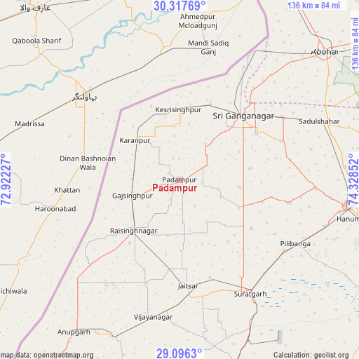
| Upper-left | 30.31769°, | 72.92227° |
| Center: | 29.70885°, | 73.62539° |
| Lower-right: | 29.0963°, | 74.32852° |
| Map W x H: | 135.8×135.8 km | = 84.4×84.4mi |
| max Lat: | 34.9274° ⇑8.1% North |
| Padampur: | 29.70885° |
| min Lat: | ⇓91.9% South 8.09008° |
| min Long | Padampur | max Long |
| 68.82655° | 73.62539° | 96.81° |
| W 7.9%⇐ | ⇒92.1% E |
Elevation
Elevation of Padampur is 170 m = 558 ft, and this is 125.6 m = 412 ft below average elevation for this country.
| Max E: |
3681 m = 12077 ft | 56% |
| Avg. | 295.6 m = 970 ft | |
| Padampur | 170 m = 558 ft | |
Min E: |
1 m = 3 ft | 44% |
See also: India elevation on elevation.city.
Geographical zone
Padampur is located in North temperate zone (between Tropic of Cancer and the Arctic Circle). Distance of this Northern Tropic circle is 697.4 km =433.3 mi to South.| Distance of | km | miles | from Padampur |
|---|---|---|---|
| North Pole | 6703.7 | 4165.5 | to North |
| Arctic Circle | 4097.9 | 2546.3 | to North |
| Tropic Cancer | 697.4 | 433.3 | to South |
| Equator | 3303.3 | 2052.6 | to South |


Nearby cities:
15 places around Padampur: (largest is in red/bold)
• Abohar
73.2 km =45.5 mi,  48°
48°
• Anūpgarh
70.3 km =43.7 mi,  215°
215°
• Dabwāli
110.6 km =68.7 mi,  76°
76°
• Ellenabad
104.1 km =64.7 mi,  105°
105°
• Fāzilka
86.3 km =53.6 mi,  26°
26°
• Gangānagar
33.6 km =20.9 mi, 45°
• Giddarbāha
114.2 km =71 mi,  61°
61°
• Hanumāngarh
69.5 km =43.2 mi,  101°
101°
• Karanpur
22 km =13.7 mi,  311°
311°
• Malaut
99.6 km =61.9 mi, 55°
• Pilibangan
54.3 km =33.7 mi,  122°
122°
• Rāisinghnagar
25.7 km =16 mi, 221°
• Rāwatsār
89.9 km =55.9 mi, 123°
• Sangariā
81.8 km =50.8 mi, 82°
• Sūratgarh
50.6 km =31.4 mi,  148°
148°
Sources, notices
• [Note1] Compared only with cities in India existing in our database
• [Src1] Map data: © OpenStreetMap contributors (CC-BY-SA)
• [Src2] Other city data from geonames.org with taken over terms of usage.
• [Src3] Geographical zone / Annual Mean Temperature by Robert A. Rohde @ Wikipedia
