Mau geodata
Mau (Madhya Pradesh) is a populated place; located in India in Asia/Kolkata (GMT+5.5) time zone. With population of 19,299 people, there are 2099 cities with bigger population in this country. Compared to other cities in India, 72.6% of cities are located further ↓South; 55.7% of cities are located further ←West and 56.6% of cities have higher elevation than Mau. Note1


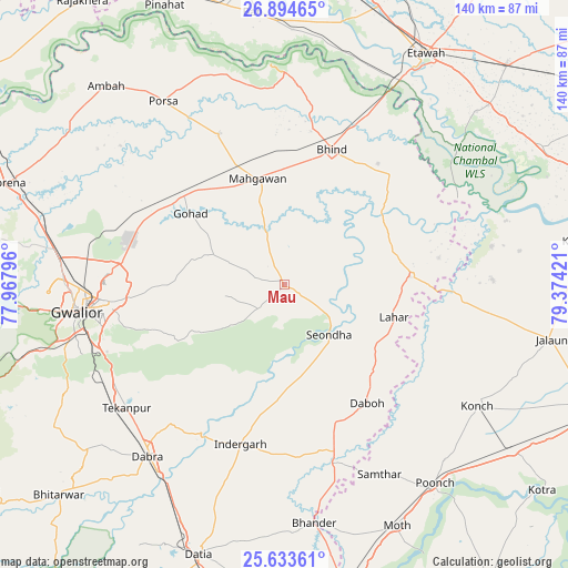
Mau GPS coordinates[2]
26° 15' 57.024" North, 78° 40' 15.888" East
| Map corner | latitude | longitude |
|---|---|---|
| Upper-left | 26.89465°, | 77.96796° |
| Center: | 26.26584°, | 78.67108° |
| Lower-right: | 25.63361°, | 79.37421° |
| Map W x H: | 140.2×140.2 km | = 87.1×87.1mi |
| max Lat: | 34.9274° ⇑27.4% North |
| Mau: | 26.26584° |
| min Lat: | ⇓72.6% South 8.09008° |
| min Long | Mau | max Long |
| 68.82655° | 78.67108° | 96.81° |
| W 55.7%⇐ | ⇒44.3% E |
Elevation
Elevation of Mau is 167 m = 548 ft, and this is 128.6 m = 422 ft below average elevation for this country.
| Max E: |
3681 m = 12077 ft | 56.6% |
| Avg. | 295.6 m = 970 ft | |
| Mau | 167 m = 548 ft | |
Min E: |
1 m = 3 ft | 43.4% |
See also: India elevation on elevation.city.
Geographical zone
Mau is located in North temperate zone (between Tropic of Cancer and the Arctic Circle). Distance of this Northern Tropic circle is 314.6 km =195.5 mi to South.| Distance of | km | miles | from Mau |
|---|---|---|---|
| North Pole | 7086.6 | 4403.4 | to North |
| Arctic Circle | 4480.7 | 2784.2 | to North |
| Tropic Cancer | 314.6 | 195.5 | to South |
| Equator | 2920.5 | 1814.7 | to South |


Nearby cities:
15 places around Mau: (largest is in red/bold)
• Alampur
29.6 km =18.4 mi,  154°
154°
• Antri
51.5 km =32 mi,  243°
243°
• Bhind
35.4 km =22 mi,  19°
19°
• Daboh
35.8 km =22.2 mi,  144°
144°
• Gohadi
29.4 km =18.3 mi,  309°
309°
• Gwalior
49.8 km =30.9 mi,  265°
265°
• Lahār
28.1 km =17.5 mi,  106°
106°
• Mahgawān
26 km =16.2 mi,  347°
347°
• Mihona
30.9 km =19.2 mi,  86°
86°
• Morār
44.7 km =27.8 mi,  264°
264°
• Mādhogarh
51.3 km =31.9 mi, 88°
• Nadīgaon
39.2 km =24.4 mi,  116°
116°
• Seondha
16.6 km =10.3 mi, 138°
• Tekanpur
49.1 km =30.5 mi,  232°
232°
• Umri
38 km =23.6 mi,  44°
44°
Sources, notices
• [Note1] Compared only with cities in India existing in our database
• [Src1] Map data: © OpenStreetMap contributors (CC-BY-SA)
• [Src2] Other city data from geonames.org with taken over terms of usage.
• [Src3] Geographical zone / Annual Mean Temperature by Robert A. Rohde @ Wikipedia
