Lāthi geodata
Lāthi (Gujarat) is a populated place; located in India in Asia/Kolkata (GMT+5.5) time zone. With population of 22,745 people, there are 1854 cities with bigger population in this country. Compared to other cities in India, 57.8% of cities are located further ↑North; 98.1% of cities are located further →East and 63.4% of cities have higher elevation than Lāthi. Note1


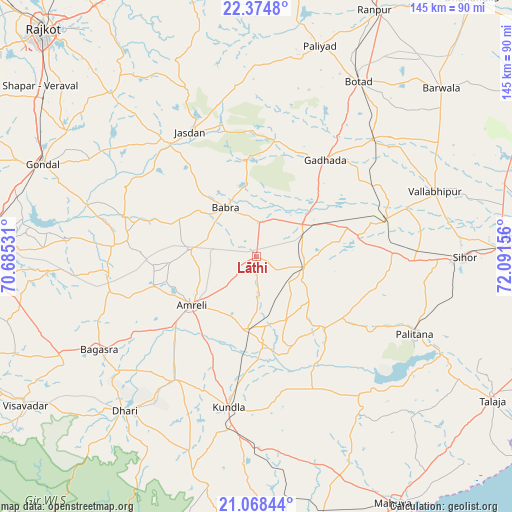
Lāthi GPS coordinates[2]
21° 43' 23.16" North, 71° 23' 18.348" East
| Map corner | latitude | longitude |
|---|---|---|
| Upper-left | 22.3748°, | 70.68531° |
| Center: | 21.7231°, | 71.38843° |
| Lower-right: | 21.06844°, | 72.09156° |
| Map W x H: | 145.3×145.3 km | = 90.3×90.3mi |
| max Lat: | 34.9274° ⇑57.8% North |
| Lāthi: | 21.7231° |
| min Lat: | ⇓42.2% South 8.09008° |
| min Long | Lāthi | max Long |
| 68.82655° | 71.38843° | 96.81° |
| W 1.9%⇐ | ⇒98.1% E |
Elevation
Elevation of Lāthi is 130 m = 427 ft, and this is 165.6 m = 543 ft below average elevation for this country.
| Max E: |
3681 m = 12077 ft | 63.4% |
| Avg. | 295.6 m = 970 ft | |
| Lāthi | 130 m = 427 ft | |
Min E: |
1 m = 3 ft | 36.6% |
See also: India elevation on elevation.city.
Geographical zone
Lāthi is located in North Torrid zone (between Equator and Tropic of Cancer). Distance of this Northern Tropic circle is 190.5 km =118.4 mi to North.| Distance of | km | miles | from Lāthi |
|---|---|---|---|
| North Pole | 7591.7 | 4717.3 | to North |
| Arctic Circle | 4985.8 | 3098 | to North |
| Tropic Cancer | 190.5 | 118.4 | to North |
| Equator | 2415.4 | 1500.9 | to South |


Nearby cities:
15 places around Lāthi: (largest is in red/bold)
• Amreli
22.8 km =14.2 mi,  233°
233°
• Bagasra
51.9 km =32.2 mi,  239°
239°
• Bābra
16.1 km =10 mi,  327°
327°
• Chalāla
41.6 km =25.8 mi,  213°
213°
• Dhola
43.4 km =27 mi,  66°
66°
• Dāmnagar
13.8 km =8.6 mi,  104°
104°
• Gadhada
33.7 km =20.9 mi,  35°
35°
• Gariadhar
28.3 km =17.6 mi,  136°
136°
• Jasdan
39.6 km =24.6 mi, 331°
• Kundla
43.2 km =26.8 mi,  191°
191°
• Pālitāna
50 km =31.1 mi,  116°
116°
• Savarkundla
43.8 km =27.2 mi, 191°
• Umrāla
44.9 km =27.9 mi, 72°
• Valabhīpur
53.9 km =33.5 mi, 70°
• Vinchia
54.2 km =33.7 mi,  359°
359°
Sources, notices
• [Note1] Compared only with cities in India existing in our database
• [Src1] Map data: © OpenStreetMap contributors (CC-BY-SA)
• [Src2] Other city data from geonames.org with taken over terms of usage.
• [Src3] Geographical zone / Annual Mean Temperature by Robert A. Rohde @ Wikipedia
