Bābra geodata
Bābra (Gujarat) is a populated place; located in India in Asia/Kolkata (GMT+5.5) time zone. With population of 18,993 people, there are 2125 cities with bigger population in this country. Compared to other cities in India, 57.3% of cities are located further ↑North; 98.2% of cities are located further →East and 57.4% of cities have higher elevation than Bābra. Note1


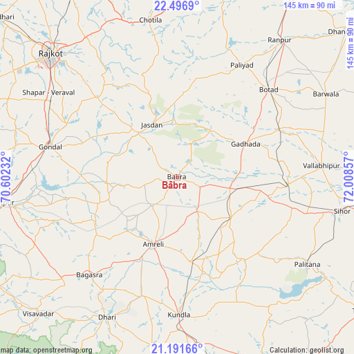
Bābra GPS coordinates[2]
21° 50' 44.772" North, 71° 18' 19.584" East
| Map corner | latitude | longitude |
|---|---|---|
| Upper-left | 22.4969°, | 70.60232° |
| Center: | 21.84577°, | 71.30544° |
| Lower-right: | 21.19166°, | 72.00857° |
| Map W x H: | 145.1×145.1 km | = 90.2×90.2mi |
| max Lat: | 34.9274° ⇑57.3% North |
| Bābra: | 21.84577° |
| min Lat: | ⇓42.7% South 8.09008° |
| min Long | Bābra | max Long |
| 68.82655° | 71.30544° | 96.81° |
| W 1.8%⇐ | ⇒98.2% E |
Elevation
Elevation of Bābra is 161 m = 528 ft, and this is 134.6 m = 442 ft below average elevation for this country.
| Max E: |
3681 m = 12077 ft | 57.4% |
| Avg. | 295.6 m = 970 ft | |
| Bābra | 161 m = 528 ft | |
Min E: |
1 m = 3 ft | 42.6% |
See also: India elevation on elevation.city.
Geographical zone
Bābra is located in North Torrid zone (between Equator and Tropic of Cancer). Distance of this Northern Tropic circle is 176.9 km =109.9 mi to North.| Distance of | km | miles | from Bābra |
|---|---|---|---|
| North Pole | 7578 | 4708.7 | to North |
| Arctic Circle | 4972.2 | 3089.6 | to North |
| Tropic Cancer | 176.9 | 109.9 | to North |
| Equator | 2429 | 1509.3 | to South |


Nearby cities:
15 places around Bābra: (largest is in red/bold)
• Amreli
29 km =18 mi,  199°
199°
• Bagasra
53.8 km =33.4 mi,  222°
222°
• Botād
51.8 km =32.2 mi,  46°
46°
• Chalāla
50.5 km =31.4 mi, 196°
• Dhola
48.4 km =30.1 mi,  85°
85°
• Dāmnagar
27.8 km =17.3 mi,  127°
127°
• Gadhada
31.3 km =19.4 mi,  63°
63°
• Gariadhar
44.2 km =27.5 mi,  140°
140°
• Gondal
53.4 km =33.2 mi,  283°
283°
• Jasdan
23.5 km =14.6 mi,  334°
334°
• Kundla
56 km =34.8 mi,  179°
179°
• Lāthi
16.1 km =10 mi,  147°
147°
• Pāliyād
52.8 km =32.8 mi,  29°
29°
• Umrāla
51.4 km =31.9 mi, 90°
• Vinchia
41.2 km =25.6 mi,  10°
10°
Sources, notices
• [Note1] Compared only with cities in India existing in our database
• [Src1] Map data: © OpenStreetMap contributors (CC-BY-SA)
• [Src2] Other city data from geonames.org with taken over terms of usage.
• [Src3] Geographical zone / Annual Mean Temperature by Robert A. Rohde @ Wikipedia
