Lar geodata
Lar (Uttar Pradesh) is a populated place; located in India in Asia/Kolkata (GMT+5.5) time zone. With population of 26,688 people, there are 1599 cities with bigger population in this country. Compared to other cities in India, 72% of cities are located further ↓South; 81.8% of cities are located further ←West and 74.2% of cities have higher elevation than Lar. Note1


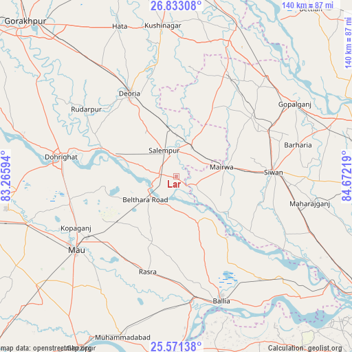
Lar GPS coordinates[2]
26° 12' 14.184" North, 83° 58' 8.616" East
| Map corner | latitude | longitude |
|---|---|---|
| Upper-left | 26.83308°, | 83.26594° |
| Center: | 26.20394°, | 83.96906° |
| Lower-right: | 25.57138°, | 84.67219° |
| Map W x H: | 140.3×140.3 km | = 87.2×87.2mi |
| max Lat: | 34.9274° ⇑28% North |
| Lar: | 26.20394° |
| min Lat: | ⇓72% South 8.09008° |
| min Long | Lar | max Long |
| 68.82655° | 83.96906° | 96.81° |
| W 81.8%⇐ | ⇒18.2% E |
Elevation
Elevation of Lar is 72 m = 236 ft, and this is 223.6 m = 734 ft below average elevation for this country.
| Max E: |
3681 m = 12077 ft | 74.2% |
| Avg. | 295.6 m = 970 ft | |
| Lar | 72 m = 236 ft | |
Min E: |
1 m = 3 ft | 25.8% |
See also: India elevation on elevation.city.
Geographical zone
Lar is located in North temperate zone (between Tropic of Cancer and the Arctic Circle). Distance of this Northern Tropic circle is 307.7 km =191.2 mi to South.| Distance of | km | miles | from Lar |
|---|---|---|---|
| North Pole | 7093.5 | 4407.7 | to North |
| Arctic Circle | 4487.6 | 2788.5 | to North |
| Tropic Cancer | 307.7 | 191.2 | to South |
| Equator | 2913.6 | 1810.4 | to South |


Nearby cities:
15 places around Lar: (largest is in red/bold)
• Bilthra
11.5 km =7.1 mi,  222°
222°
• Bānsdīh
43.4 km =27 mi,  145°
145°
• Chillupār
47 km =29.2 mi,  280°
280°
• Deoria
38.1 km =23.7 mi,  330°
330°
• Dohrighāt
46.5 km =28.9 mi, 279°
• Ghosī
44.3 km =27.5 mi,  255°
255°
• Kopāganj
45.2 km =28.1 mi,  242°
242°
• Mahārājgani
54.4 km =33.8 mi,  101°
101°
• Mairwa
19.6 km =12.2 mi,  80°
80°
• Maniar
31.7 km =19.7 mi,  140°
140°
• Mau
50.1 km =31.1 mi,  234°
234°
• Rasrā
40.2 km =25 mi,  196°
196°
• Rūdarpur
44.4 km =27.6 mi,  307°
307°
• Sikandarpur
19.7 km =12.2 mi, 154°
• Siwān
38.7 km =24 mi,  87°
87°
Sources, notices
• [Note1] Compared only with cities in India existing in our database
• [Src1] Map data: © OpenStreetMap contributors (CC-BY-SA)
• [Src2] Other city data from geonames.org with taken over terms of usage.
• [Src3] Geographical zone / Annual Mean Temperature by Robert A. Rohde @ Wikipedia
