Lālsot geodata
Lālsot (Rajasthan) is a populated place; located in India in Asia/Kolkata (GMT+5.5) time zone. With population of 31,480 people, there are 1377 cities with bigger population in this country. Compared to other cities in India, 75.1% of cities are located further ↓South; 70.2% of cities are located further →East and 68% of cities have lower elevation than Lālsot. Note1


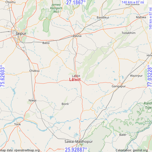
Lālsot GPS coordinates[2]
26° 33' 34.236" North, 76° 19' 44.94" East
| Map corner | latitude | longitude |
|---|---|---|
| Upper-left | 27.1867°, | 75.62603° |
| Center: | 26.55951°, | 76.32915° |
| Lower-right: | 25.92887°, | 77.03228° |
| Map W x H: | 139.9×139.9 km | = 86.9×86.9mi |
| max Lat: | 34.9274° ⇑24.9% North |
| Lālsot: | 26.55951° |
| min Lat: | ⇓75.1% South 8.09008° |
| min Long | Lālsot | max Long |
| 68.82655° | 76.32915° | 96.81° |
| W 29.8%⇐ | ⇒70.2% E |
Elevation
Elevation of Lālsot is 308 m = 1010 ft, and this is 12.4 m = 41 ft above average elevation for this country.
| Max E: |
3681 m = 12077 ft | 32% |
| Lālsot | 308 m 1010 ft | |
| Avg. | 295.6 m = 970 ft | |
Min E: |
1 m = 3 ft | 68% |
See also: India elevation on elevation.city.
Geographical zone
Lālsot is located in North temperate zone (between Tropic of Cancer and the Arctic Circle). Distance of this Northern Tropic circle is 347.2 km =215.7 mi to South.| Distance of | km | miles | from Lālsot |
|---|---|---|---|
| North Pole | 7053.9 | 4383.1 | to North |
| Arctic Circle | 4448 | 2763.9 | to North |
| Tropic Cancer | 347.2 | 215.7 | to South |
| Equator | 2953.1 | 1835 | to South |


Nearby cities:
15 places around Lālsot: (largest is in red/bold)
• Abhaneri
57 km =35.4 mi,  29°
29°
• Basi
41.1 km =25.5 mi,  317°
317°
• Baswa
70.3 km =43.7 mi,  21°
21°
• Bāndīkūi
59.8 km =37.2 mi, 23°
• Chaksu
38.2 km =23.7 mi,  277°
277°
• Dausa
36.8 km =22.9 mi,  1°
1°
• Gangāpur
39.8 km =24.7 mi,  104°
104°
• Hindaun
72.8 km =45.2 mi,  74°
74°
• Jaipur
67 km =41.6 mi,  306°
306°
• Karauli
69.8 km =43.4 mi, 95°
• Mahwah
80.6 km =50.1 mi,  47°
47°
• Niwai
46.5 km =28.9 mi,  241°
241°
• Sawāi Mādhopur
59.7 km =37.1 mi,  178°
178°
• Todabhim
62.6 km =38.9 mi, 50°
• Tonk
69.4 km =43.1 mi,  230°
230°
Sources, notices
• [Note1] Compared only with cities in India existing in our database
• [Src1] Map data: © OpenStreetMap contributors (CC-BY-SA)
• [Src2] Other city data from geonames.org with taken over terms of usage.
• [Src3] Geographical zone / Annual Mean Temperature by Robert A. Rohde @ Wikipedia
