Lakhnā geodata
Lakhnā (Uttar Pradesh) is a populated place; located in India in Asia/Kolkata (GMT+5.5) time zone. With population of 11,389 people, there are 2793 cities with bigger population in this country. Compared to other cities in India, 75.7% of cities are located further ↓South; 60.5% of cities are located further ←West and 58.6% of cities have higher elevation than Lakhnā. Note1


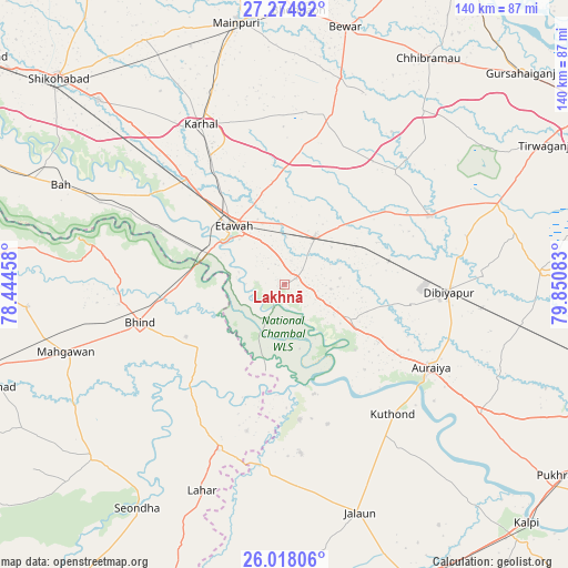
Lakhnā GPS coordinates[2]
26° 38' 53.592" North, 79° 8' 51.72" East
| Map corner | latitude | longitude |
|---|---|---|
| Upper-left | 27.27492°, | 78.44458° |
| Center: | 26.64822°, | 79.1477° |
| Lower-right: | 26.01806°, | 79.85083° |
| Map W x H: | 139.7×139.8 km | = 86.8×86.9mi |
| max Lat: | 34.9274° ⇑24.3% North |
| Lakhnā: | 26.64822° |
| min Lat: | ⇓75.7% South 8.09008° |
| min Long | Lakhnā | max Long |
| 68.82655° | 79.1477° | 96.81° |
| W 60.5%⇐ | ⇒39.5% E |
Elevation
Elevation of Lakhnā is 155 m = 509 ft, and this is 140.6 m = 461 ft below average elevation for this country.
| Max E: |
3681 m = 12077 ft | 58.6% |
| Avg. | 295.6 m = 970 ft | |
| Lakhnā | 155 m = 509 ft | |
Min E: |
1 m = 3 ft | 41.4% |
See also: India elevation on elevation.city.
Geographical zone
Lakhnā is located in North temperate zone (between Tropic of Cancer and the Arctic Circle). Distance of this Northern Tropic circle is 357.1 km =221.9 mi to South.| Distance of | km | miles | from Lakhnā |
|---|---|---|---|
| North Pole | 7044.1 | 4377 | to North |
| Arctic Circle | 4438.2 | 2757.8 | to North |
| Tropic Cancer | 357.1 | 221.9 | to South |
| Equator | 2963 | 1841.1 | to South |


Nearby cities:
15 places around Lakhnā: (largest is in red/bold)
• Auraiya
41.3 km =25.7 mi,  119°
119°
• Bakewar
3.2 km =2 mi,  61°
61°
• Bharthana
13.7 km =8.5 mi,  32°
32°
• Bhind
37 km =23 mi,  255°
255°
• Bidhūna
39.7 km =24.7 mi, 64°
• Etāwah
19 km =11.8 mi,  318°
318°
• Jaswantnagar
35.7 km =22.2 mi, 316°
• Karhal
44.3 km =27.5 mi,  332°
332°
• Kishni
43.4 km =27 mi,  15°
15°
• Mihona
43.8 km =27.2 mi,  202°
202°
• Mādhogarh
41.6 km =25.8 mi,  174°
174°
• Phaphūnd
32 km =19.9 mi,  99°
99°
• Rāmpura
33.4 km =20.8 mi, 174°
• Sarai Ekdil
12 km =7.5 mi, 333°
• Umri
26 km =16.2 mi,  233°
233°
Sources, notices
• [Note1] Compared only with cities in India existing in our database
• [Src1] Map data: © OpenStreetMap contributors (CC-BY-SA)
• [Src2] Other city data from geonames.org with taken over terms of usage.
• [Src3] Geographical zone / Annual Mean Temperature by Robert A. Rohde @ Wikipedia
