Kotapārh geodata
Kotapārh (Chhattisgarh) is a populated place; located in India in Asia/Kolkata (GMT+5.5) time zone. With population of 15,479 people, there are 2415 cities with bigger population in this country. Compared to other cities in India, 68.2% of cities are located further ↑North; 77.5% of cities are located further ←West and 86% of cities have lower elevation than Kotapārh. Note1


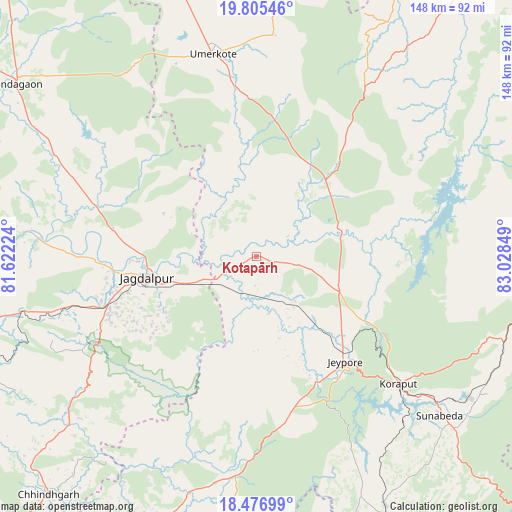
Kotapārh GPS coordinates[2]
19° 8' 33.216" North, 82° 19' 31.296" East
| Map corner | latitude | longitude |
|---|---|---|
| Upper-left | 19.80546°, | 81.62224° |
| Center: | 19.14256°, | 82.32536° |
| Lower-right: | 18.47699°, | 83.02849° |
| Map W x H: | 147.7×147.7 km | = 91.8×91.8mi |
| max Lat: | 34.9274° ⇑68.2% North |
| Kotapārh: | 19.14256° |
| min Lat: | ⇓31.8% South 8.09008° |
| min Long | Kotapārh | max Long |
| 68.82655° | 82.32536° | 96.81° |
| W 77.5%⇐ | ⇒22.5% E |
Elevation
Elevation of Kotapārh is 561 m = 1841 ft, and this is 265.4 m = 871 ft above average elevation for this country.
| Max E: |
3681 m = 12077 ft | 14% |
| Kotapārh | 561 m 1841 ft | |
| Avg. | 295.6 m = 970 ft | |
Min E: |
1 m = 3 ft | 86% |
See also: India elevation on elevation.city.
Geographical zone
Kotapārh is located in North Torrid zone (between Equator and Tropic of Cancer). Distance of this Northern Tropic circle is 477.5 km =296.7 mi to North.| Distance of | km | miles | from Kotapārh |
|---|---|---|---|
| North Pole | 7878.6 | 4895.5 | to North |
| Arctic Circle | 5272.7 | 3276.3 | to North |
| Tropic Cancer | 477.5 | 296.7 | to North |
| Equator | 2128.5 | 1322.6 | to South |


Nearby cities:
15 places around Kotapārh: (largest is in red/bold)
• Balimila
101.7 km =63.2 mi,  193°
193°
• Bhawānipatna
122.5 km =76.1 mi,  46°
46°
• Chittarkonda
115.4 km =71.7 mi, 191°
• Gīdam
99.1 km =61.6 mi,  259°
259°
• Jagdalpur
32.7 km =20.3 mi, 257°
• Jeypore
41 km =25.5 mi,  140°
140°
• Jūnāgarh
102.1 km =63.4 mi,  38°
38°
• Kondagaon
85.4 km =53.1 mi,  305°
305°
• Korāput
54.7 km =34 mi,  132°
132°
• Malakanagiri
98 km =60.9 mi,  208°
208°
• Nowrangapur
25.4 km =15.8 mi,  67°
67°
• Pārvatipuram
122.4 km =76.1 mi,  109°
109°
• Sukma
109.2 km =67.9 mi,  219°
219°
• Sālūr
115.8 km =72 mi, 126°
• Umarkot
59.4 km =36.9 mi,  347°
347°
Sources, notices
• [Note1] Compared only with cities in India existing in our database
• [Src1] Map data: © OpenStreetMap contributors (CC-BY-SA)
• [Src2] Other city data from geonames.org with taken over terms of usage.
• [Src3] Geographical zone / Annual Mean Temperature by Robert A. Rohde @ Wikipedia
