Jūnāgarh geodata
Jūnāgarh (Chhattisgarh) is a populated place; located in India in Asia/Kolkata (GMT+5.5) time zone. With population of 16,856 people, there are 2298 cities with bigger population in this country. Compared to other cities in India, 65.8% of cities are located further ↑North; 79.1% of cities are located further ←West and 54.8% of cities have lower elevation than Jūnāgarh. Note1


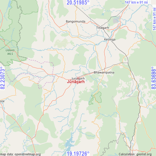
Jūnāgarh GPS coordinates[2]
19° 51' 35.748" North, 82° 56' 1.86" East
| Map corner | latitude | longitude |
|---|---|---|
| Upper-left | 20.51985°, | 82.23073° |
| Center: | 19.85993°, | 82.93385° |
| Lower-right: | 19.19726°, | 83.63698° |
| Map W x H: | 147.1×147.1 km | = 91.4×91.4mi |
| max Lat: | 34.9274° ⇑65.8% North |
| Jūnāgarh: | 19.85993° |
| min Lat: | ⇓34.2% South 8.09008° |
| min Long | Jūnāgarh | max Long |
| 68.82655° | 82.93385° | 96.81° |
| W 79.1%⇐ | ⇒20.9% E |
Elevation
Elevation of Jūnāgarh is 226 m = 741 ft, and this is 69.6 m = 228 ft below average elevation for this country.
| Max E: |
3681 m = 12077 ft | 45.2% |
| Avg. | 295.6 m = 970 ft | |
| Jūnāgarh | 226 m = 741 ft | |
Min E: |
1 m = 3 ft | 54.8% |
See also: India elevation on elevation.city.
Geographical zone
Jūnāgarh is located in North Torrid zone (between Equator and Tropic of Cancer). Distance of this Northern Tropic circle is 397.7 km =247.1 mi to North.| Distance of | km | miles | from Jūnāgarh |
|---|---|---|---|
| North Pole | 7798.8 | 4845.9 | to North |
| Arctic Circle | 5193 | 3226.8 | to North |
| Tropic Cancer | 397.7 | 247.1 | to North |
| Equator | 2208.2 | 1372.1 | to South |


Nearby cities:
15 places around Jūnāgarh: (largest is in red/bold)
• Balāngīr
110.4 km =68.6 mi,  31°
31°
• Bhawānipatna
24.9 km =15.5 mi,  77°
77°
• Gariāband
125.1 km =77.7 mi,  313°
313°
• Gudāri
105.5 km =65.6 mi,  122°
122°
• Jeypore
117.9 km =73.3 mi,  198°
198°
• Kantābānji
67.5 km =41.9 mi,  358°
358°
• Kesinga
47.1 km =29.3 mi,  39°
39°
• Kharhiāl
51 km =31.7 mi,  339°
339°
• Korāput
118.9 km =73.9 mi,  191°
191°
• Kotapārh
102.1 km =63.4 mi,  218°
218°
• Nowrangapur
80.7 km =50.1 mi,  210°
210°
• Patnāgarh
96.6 km =60 mi,  12°
12°
• Tarabha
124 km =77.1 mi, 38°
• Titlāgarh
52.9 km =32.9 mi, 25°
• Umarkot
79.1 km =49.2 mi,  254°
254°
Sources, notices
• [Note1] Compared only with cities in India existing in our database
• [Src1] Map data: © OpenStreetMap contributors (CC-BY-SA)
• [Src2] Other city data from geonames.org with taken over terms of usage.
• [Src3] Geographical zone / Annual Mean Temperature by Robert A. Rohde @ Wikipedia
