Balimila geodata
Balimila (Odisha) is a populated place; located in India in Asia/Kolkata (GMT+5.5) time zone. With population of 12,008 people, there are 2739 cities with bigger population in this country. Compared to other cities in India, 71.2% of cities are located further ↑North; 76.9% of cities are located further ←West and 51.4% of cities have lower elevation than Balimila. Note1


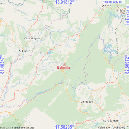
Balimila GPS coordinates[2]
18° 15' 6.012" North, 82° 6' 23.724" East
| Map corner | latitude | longitude |
|---|---|---|
| Upper-left | 18.91812°, | 81.40347° |
| Center: | 18.25167°, | 82.10659° |
| Lower-right: | 17.58265°, | 82.80972° |
| Map W x H: | 148.5×148.5 km | = 92.3×92.3mi |
| max Lat: | 34.9274° ⇑71.2% North |
| Balimila: | 18.25167° |
| min Lat: | ⇓28.8% South 8.09008° |
| min Long | Balimila | max Long |
| 68.82655° | 82.10659° | 96.81° |
| W 76.9%⇐ | ⇒23.1% E |
Elevation
Elevation of Balimila is 210 m = 689 ft, and this is 85.6 m = 281 ft below average elevation for this country.
| Max E: |
3681 m = 12077 ft | 48.6% |
| Avg. | 295.6 m = 970 ft | |
| Balimila | 210 m = 689 ft | |
Min E: |
1 m = 3 ft | 51.4% |
See also: India elevation on elevation.city.
Geographical zone
Balimila is located in North Torrid zone (between Equator and Tropic of Cancer). Distance of this Northern Tropic circle is 576.5 km =358.2 mi to North.| Distance of | km | miles | from Balimila |
|---|---|---|---|
| North Pole | 7977.7 | 4957.1 | to North |
| Arctic Circle | 5371.8 | 3337.9 | to North |
| Tropic Cancer | 576.5 | 358.2 | to North |
| Equator | 2029.4 | 1261 | to South |


Nearby cities:
15 places around Balimila: (largest is in red/bold)
• Akasahebpet
96.2 km =59.8 mi,  149°
149°
• Chittarkonda
14 km =8.7 mi,  179°
179°
• Chodavaram
99.4 km =61.8 mi,  118°
118°
• Etikoppāka
106.7 km =66.3 mi,  141°
141°
• Jagdalpur
92.7 km =57.6 mi,  354°
354°
• Jeypore
83.2 km =51.7 mi,  36°
36°
• Kirandul
99.2 km =61.6 mi,  295°
295°
• Korāput
89.1 km =55.4 mi,  45°
45°
• Kotapārh
101.7 km =63.2 mi,  13°
13°
• Malakanagiri
26.3 km =16.3 mi, 298°
• Mādugula
83.7 km =52 mi, 116°
• Narsīpatnam
84.2 km =52.3 mi, 140°
• Rampachodavaram
96.7 km =60.1 mi,  201°
201°
• Sukma
49.6 km =30.8 mi,  288°
288°
• Tuni
109.6 km =68.1 mi, 154°
Sources, notices
• [Note1] Compared only with cities in India existing in our database
• [Src1] Map data: © OpenStreetMap contributors (CC-BY-SA)
• [Src2] Other city data from geonames.org with taken over terms of usage.
• [Src3] Geographical zone / Annual Mean Temperature by Robert A. Rohde @ Wikipedia
