Kareli geodata
Kareli (Madhya Pradesh) is a populated place; located in India in Asia/Kolkata (GMT+5.5) time zone. With population of 27,808 people, there are 1550 cities with bigger population in this country. Compared to other cities in India, 51% of cities are located further ↓South; 59.5% of cities are located further ←West and 73.4% of cities have lower elevation than Kareli. Note1


Kareli GPS coordinates[2]
22° 54' 55.188" North, 79° 3' 49.608" East
| Map corner | latitude | longitude |
|---|---|---|
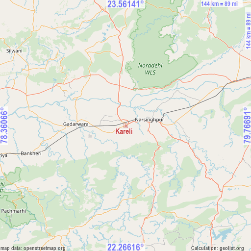
| Upper-left | 23.56141°, | 78.36066° |
| Center: | 22.91533°, | 79.06378° |
| Lower-right: | 22.26616°, | 79.76691° |
| Map W x H: | 144×144 km | = 89.5×89.5mi |
| max Lat: | 34.9274° ⇑49% North |
| Kareli: | 22.91533° |
| min Lat: | ⇓51% South 8.09008° |
| min Long | Kareli | max Long |
| 68.82655° | 79.06378° | 96.81° |
| W 59.5%⇐ | ⇒40.5% E |
Elevation
Elevation of Kareli is 365 m = 1198 ft, and this is 69.4 m = 228 ft above average elevation for this country.
| Max E: |
3681 m = 12077 ft | 26.6% |
| Kareli | 365 m 1198 ft | |
| Avg. | 295.6 m = 970 ft | |
Min E: |
1 m = 3 ft | 73.4% |
See also: India elevation on elevation.city.
Geographical zone
Kareli is located in North Torrid zone (between Equator and Tropic of Cancer). Distance of this Northern Tropic circle is 58 km =36 mi to North.| Distance of | km | miles | from Kareli |
|---|---|---|---|
| North Pole | 7459.1 | 4634.9 | to North |
| Arctic Circle | 4853.2 | 3015.6 | to North |
| Tropic Cancer | 58 | 36 | to North |
| Equator | 2547.9 | 1583.2 | to South |


Nearby cities:
15 places around Kareli: (largest is in red/bold)
• Amarwāra
69.5 km =43.2 mi,  171°
171°
• Bargi
83.5 km =51.9 mi,  84°
84°
• Chichli
26 km =16.2 mi,  249°
249°
• Deori Khās
53 km =32.9 mi,  354°
354°
• Gādarwāra
28.6 km =17.8 mi,  271°
271°
• Harrai
37.2 km =23.1 mi,  154°
154°
• Jaithāri
56.3 km =35 mi,  305°
305°
• Lakhnādon
65.3 km =40.6 mi,  122°
122°
• Narsimhapur
12.8 km =8 mi,  72°
72°
• Pachmarhi
81.6 km =50.7 mi,  232°
232°
• Pātan
76.2 km =47.3 mi,  57°
57°
• Rehli
80.3 km =49.9 mi,  359°
359°
• Shāhpura
66.2 km =41.1 mi, 68°
• Tendūkheda
72.3 km =44.9 mi,  42°
42°
• Udaipura
59.3 km =36.8 mi,  287°
287°
Sources, notices
• [Note1] Compared only with cities in India existing in our database
• [Src1] Map data: © OpenStreetMap contributors (CC-BY-SA)
• [Src2] Other city data from geonames.org with taken over terms of usage.
• [Src3] Geographical zone / Annual Mean Temperature by Robert A. Rohde @ Wikipedia
