Jahānābād geodata
Jahānābād (Bihar) is a populated place; located in India in Asia/Kolkata (GMT+5.5) time zone. With population of 96,387 people, there are 460 cities with bigger population in this country. Compared to other cities in India, 64.6% of cities are located further ↓South; 84.2% of cities are located further ←West and 74.4% of cities have higher elevation than Jahānābād. Note1


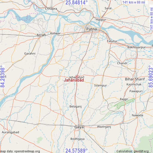
Jahānābād GPS coordinates[2]
25° 12' 49.248" North, 84° 59' 13.56" East
| Map corner | latitude | longitude |
|---|---|---|
| Upper-left | 25.84814°, | 84.28398° |
| Center: | 25.21368°, | 84.9871° |
| Lower-right: | 24.57589°, | 85.69023° |
| Map W x H: | 141.5×141.5 km | = 87.9×87.9mi |
| max Lat: | 34.9274° ⇑35.4% North |
| Jahānābād: | 25.21368° |
| min Lat: | ⇓64.6% South 8.09008° |
| min Long | Jahānābād | max Long |
| 68.82655° | 84.9871° | 96.81° |
| W 84.2%⇐ | ⇒15.8% E |
Elevation
Elevation of Jahānābād is 71 m = 233 ft, and this is 224.6 m = 737 ft below average elevation for this country.
| Max E: |
3681 m = 12077 ft | 74.4% |
| Avg. | 295.6 m = 970 ft | |
| Jahānābād | 71 m = 233 ft | |
Min E: |
1 m = 3 ft | 25.6% |
See also: Jahānābād elevation on elevation.city.
Geographical zone
Jahānābād is located in North temperate zone (between Tropic of Cancer and the Arctic Circle). Distance of this Northern Tropic circle is 197.6 km =122.8 mi to South.| Distance of | km | miles | from Jahānābād |
|---|---|---|---|
| North Pole | 7203.6 | 4476.1 | to North |
| Arctic Circle | 4597.7 | 2856.9 | to North |
| Tropic Cancer | 197.6 | 122.8 | to South |
| Equator | 2803.5 | 1742 | to South |


Nearby cities:
15 places around Jahānābād: (largest is in red/bold)
• Arrah
50.1 km =31.1 mi,  319°
319°
• Dinapore
47.5 km =29.5 mi,  7°
7°
• Fatwa
45.9 km =28.5 mi,  44°
44°
• Gaya
46.4 km =28.8 mi,  177°
177°
• Hilsa
31.8 km =19.8 mi,  68°
68°
• Islāmpur
23.5 km =14.6 mi,  110°
110°
• Khagaul
41 km =25.5 mi, 8°
• Khusropur
49.9 km =31 mi,  53°
53°
• Koelwār
45 km =28 mi,  334°
334°
• Maner
49.4 km =30.7 mi,  346°
346°
• Masaurhi Buzurg
16.3 km =10.1 mi,  16°
16°
• Patna
44.9 km =27.9 mi, 19°
• Rājgīr
48.3 km =30 mi,  115°
115°
• Silao
46.7 km =29 mi, 108°
• Tekāri
33.5 km =20.8 mi,  205°
205°
Sources, notices
• [Note1] Compared only with cities in India existing in our database
• [Src1] Map data: © OpenStreetMap contributors (CC-BY-SA)
• [Src2] Other city data from geonames.org with taken over terms of usage.
• [Src3] Geographical zone / Annual Mean Temperature by Robert A. Rohde @ Wikipedia
