Dhārūr geodata
Dhārūr (Maharashtra) is a populated place; located in India in Asia/Kolkata (GMT+5.5) time zone. With population of 19,060 people, there are 2116 cities with bigger population in this country. Compared to other cities in India, 69.2% of cities are located further ↑North; 72.5% of cities are located further →East and 92.9% of cities have lower elevation than Dhārūr. Note1


Dhārūr GPS coordinates[2]
18° 49' 12.612" North, 76° 6' 33.732" East
| Map corner | latitude | longitude |
|---|---|---|
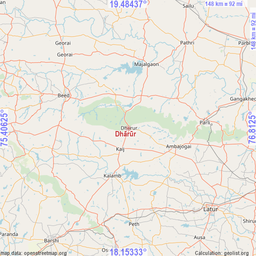
| Upper-left | 19.48437°, | 75.40625° |
| Center: | 18.82017°, | 76.10937° |
| Lower-right: | 18.15333°, | 76.8125° |
| Map W x H: | 148×148 km | = 92×92mi |
| max Lat: | 34.9274° ⇑69.2% North |
| Dhārūr: | 18.82017° |
| min Lat: | ⇓30.8% South 8.09008° |
| min Long | Dhārūr | max Long |
| 68.82655° | 76.10937° | 96.81° |
| W 27.5%⇐ | ⇒72.5% E |
Elevation
Elevation of Dhārūr is 737 m = 2418 ft, and this is 441.4 m = 1448 ft above average elevation for this country.
| Max E: |
3681 m = 12077 ft | 7.1% |
| Dhārūr | 737 m 2418 ft | |
| Avg. | 295.6 m = 970 ft | |
Min E: |
1 m = 3 ft | 92.9% |
See also: India elevation on elevation.city.
Geographical zone
Dhārūr is located in North Torrid zone (between Equator and Tropic of Cancer). Distance of this Northern Tropic circle is 513.3 km =318.9 mi to North.| Distance of | km | miles | from Dhārūr |
|---|---|---|---|
| North Pole | 7914.5 | 4917.8 | to North |
| Arctic Circle | 5308.6 | 3298.6 | to North |
| Tropic Cancer | 513.3 | 318.9 | to North |
| Equator | 2092.6 | 1300.3 | to South |


Nearby cities:
15 places around Dhārūr: (largest is in red/bold)
• Ambājogāi
30.7 km =19.1 mi,  108°
108°
• Ashti
63.1 km =39.2 mi,  11°
11°
• Ausa
75.8 km =47.1 mi,  147°
147°
• Beed
41.6 km =25.8 mi,  296°
296°
• Bhūm
62.2 km =38.6 mi,  229°
229°
• Bārsi
78.5 km =48.8 mi,  214°
214°
• Gangākher
69.4 km =43.1 mi,  76°
76°
• Gevrai
62.1 km =38.6 mi,  322°
322°
• Latur
67.4 km =41.9 mi,  134°
134°
• Mājalgaon
39.2 km =24.4 mi,  15°
15°
• Mānwat
67.3 km =41.8 mi,  37°
37°
• Osmanabad
71.4 km =44.4 mi,  185°
185°
• Parli Vaijnāth
44.6 km =27.7 mi,  85°
85°
• Pāthri
59.5 km =37 mi,  34°
34°
• Selu
78.7 km =48.9 mi, 26°
Sources, notices
• [Note1] Compared only with cities in India existing in our database
• [Src1] Map data: © OpenStreetMap contributors (CC-BY-SA)
• [Src2] Other city data from geonames.org with taken over terms of usage.
• [Src3] Geographical zone / Annual Mean Temperature by Robert A. Rohde @ Wikipedia
