Mājalgaon geodata
Mājalgaon (Maharashtra) is a populated place; located in India in Asia/Kolkata (GMT+5.5) time zone. With population of 47,845 people, there are 919 cities with bigger population in this country. Compared to other cities in India, 68.1% of cities are located further ↑North; 71.6% of cities are located further →East and 78.3% of cities have lower elevation than Mājalgaon. Note1


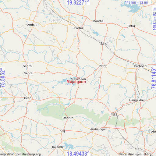
Mājalgaon GPS coordinates[2]
19° 9' 35.568" North, 76° 12' 29.952" East
| Map corner | latitude | longitude |
|---|---|---|
| Upper-left | 19.82271°, | 75.5052° |
| Center: | 19.15988°, | 76.20832° |
| Lower-right: | 18.49438°, | 76.91145° |
| Map W x H: | 147.7×147.7 km | = 91.8×91.8mi |
| max Lat: | 34.9274° ⇑68.1% North |
| Mājalgaon: | 19.15988° |
| min Lat: | ⇓31.9% South 8.09008° |
| min Long | Mājalgaon | max Long |
| 68.82655° | 76.20832° | 96.81° |
| W 28.4%⇐ | ⇒71.6% E |
Elevation
Elevation of Mājalgaon is 435 m = 1427 ft, and this is 139.4 m = 457 ft above average elevation for this country.
| Max E: |
3681 m = 12077 ft | 21.7% |
| Mājalgaon | 435 m 1427 ft | |
| Avg. | 295.6 m = 970 ft | |
Min E: |
1 m = 3 ft | 78.3% |
See also: Mājalgaon elevation on elevation.city.
Geographical zone
Mājalgaon is located in North Torrid zone (between Equator and Tropic of Cancer). Distance of this Northern Tropic circle is 475.5 km =295.5 mi to North.| Distance of | km | miles | from Mājalgaon |
|---|---|---|---|
| North Pole | 7876.7 | 4894.4 | to North |
| Arctic Circle | 5270.8 | 3275.1 | to North |
| Tropic Cancer | 475.5 | 295.5 | to North |
| Equator | 2130.4 | 1323.8 | to South |


Nearby cities:
15 places around Mājalgaon: (largest is in red/bold)
• Ambad
66.9 km =41.6 mi,  318°
318°
• Ambājogāi
51 km =31.7 mi,  158°
158°
• Ashti
24.2 km =15 mi,  4°
4°
• Beed
51.1 km =31.8 mi,  248°
248°
• Dhārūr
39.2 km =24.4 mi,  195°
195°
• Gangākher
60.7 km =37.7 mi,  110°
110°
• Gevrai
49.5 km =30.8 mi,  283°
283°
• Jintūr
71.1 km =44.2 mi,  44°
44°
• Jālna
82.9 km =51.5 mi,  335°
335°
• Mānwat
34.2 km =21.3 mi,  62°
62°
• Parbhani
60.3 km =37.5 mi,  78°
78°
• Parli Vaijnāth
48.4 km =30.1 mi,  135°
135°
• Partūr
48.9 km =30.4 mi, 0°
• Pāthri
26.1 km =16.2 mi,  65°
65°
• Selu
40.9 km =25.4 mi, 36°
Sources, notices
• [Note1] Compared only with cities in India existing in our database
• [Src1] Map data: © OpenStreetMap contributors (CC-BY-SA)
• [Src2] Other city data from geonames.org with taken over terms of usage.
• [Src3] Geographical zone / Annual Mean Temperature by Robert A. Rohde @ Wikipedia
