Kirandul geodata
Kirandul (Chhattisgarh) is a populated place; located in India in Asia/Kolkata (GMT+5.5) time zone. With population of 19,053 people, there are 2117 cities with bigger population in this country. Compared to other cities in India, 70% of cities are located further ↑North; 73.8% of cities are located further ←West and 89.9% of cities have lower elevation than Kirandul. Note1


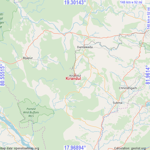
Kirandul GPS coordinates[2]
18° 38' 11.364" North, 81° 15' 29.772" East
| Map corner | latitude | longitude |
|---|---|---|
| Upper-left | 19.30143°, | 80.55515° |
| Center: | 18.63649°, | 81.25827° |
| Lower-right: | 17.96894°, | 81.9614° |
| Map W x H: | 148.2×148.2 km | = 92.1×92.1mi |
| max Lat: | 34.9274° ⇑70% North |
| Kirandul: | 18.63649° |
| min Lat: | ⇓30% South 8.09008° |
| min Long | Kirandul | max Long |
| 68.82655° | 81.25827° | 96.81° |
| W 73.8%⇐ | ⇒26.2% E |
Elevation
Elevation of Kirandul is 634 m = 2080 ft, and this is 338.4 m = 1110 ft above average elevation for this country.
| Max E: |
3681 m = 12077 ft | 10.1% |
| Kirandul | 634 m 2080 ft | |
| Avg. | 295.6 m = 970 ft | |
Min E: |
1 m = 3 ft | 89.9% |
See also: India elevation on elevation.city.
Geographical zone
Kirandul is located in North Torrid zone (between Equator and Tropic of Cancer). Distance of this Northern Tropic circle is 533.7 km =331.6 mi to North.| Distance of | km | miles | from Kirandul |
|---|---|---|---|
| North Pole | 7934.9 | 4930.5 | to North |
| Arctic Circle | 5329 | 3311.3 | to North |
| Tropic Cancer | 533.7 | 331.6 | to North |
| Equator | 2072.2 | 1287.6 | to South |


Nearby cities:
15 places around Kirandul: (largest is in red/bold)
• Balimila
99.2 km =61.6 mi,  115°
115°
• Bhadrāchalam
114.5 km =71.1 mi,  199°
199°
• Chittarkonda
106.2 km =66 mi, 122°
• Chātakonda
136.7 km =84.9 mi,  208°
208°
• Gīdam
40.4 km =25.1 mi,  21°
21°
• Jagdalpur
94.3 km =58.6 mi,  58°
58°
• Jeypore
140.4 km =87.2 mi,  79°
79°
• Kondagaon
114.4 km =71.1 mi, 21°
• Kotapārh
125.6 km =78 mi, 63°
• Kottagūdem
138.4 km =86 mi, 209°
• Malakanagiri
73 km =45.4 mi,  114°
114°
• Manuguru
90.2 km =56 mi,  216°
216°
• Palwancha
132.4 km =82.3 mi, 207°
• Pāloncha
129 km =80.2 mi, 206°
• Sukma
50.4 km =31.3 mi, 122°
Sources, notices
• [Note1] Compared only with cities in India existing in our database
• [Src1] Map data: © OpenStreetMap contributors (CC-BY-SA)
• [Src2] Other city data from geonames.org with taken over terms of usage.
• [Src3] Geographical zone / Annual Mean Temperature by Robert A. Rohde @ Wikipedia
