Bhasāwar geodata
Bhasāwar (Rajasthan) is a populated place; located in India in Asia/Kolkata (GMT+5.5) time zone. With population of 18,996 people, there are 2124 cities with bigger population in this country. Compared to other cities in India, 78.7% of cities are located further ↓South; 62.6% of cities are located further →East and 53.8% of cities have lower elevation than Bhasāwar. Note1


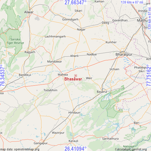
Bhasāwar GPS coordinates[2]
27° 2' 20.22" North, 77° 2' 54.564" East
| Map corner | latitude | longitude |
|---|---|---|
| Upper-left | 27.66347°, | 76.34537° |
| Center: | 27.03895°, | 77.04849° |
| Lower-right: | 26.41094°, | 77.75162° |
| Map W x H: | 139.3×139.3 km | = 86.6×86.6mi |
| max Lat: | 34.9274° ⇑21.3% North |
| Bhasāwar: | 27.03895° |
| min Lat: | ⇓78.7% South 8.09008° |
| min Long | Bhasāwar | max Long |
| 68.82655° | 77.04849° | 96.81° |
| W 37.4%⇐ | ⇒62.6% E |
Elevation
Elevation of Bhasāwar is 221 m = 725 ft, and this is 74.6 m = 245 ft below average elevation for this country.
| Max E: |
3681 m = 12077 ft | 46.2% |
| Avg. | 295.6 m = 970 ft | |
| Bhasāwar | 221 m = 725 ft | |
Min E: |
1 m = 3 ft | 53.8% |
See also: India elevation on elevation.city.
Geographical zone
Bhasāwar is located in North temperate zone (between Tropic of Cancer and the Arctic Circle). Distance of this Northern Tropic circle is 400.5 km =248.9 mi to South.| Distance of | km | miles | from Bhasāwar |
|---|---|---|---|
| North Pole | 7000.6 | 4350 | to North |
| Arctic Circle | 4394.7 | 2730.7 | to North |
| Tropic Cancer | 400.5 | 248.9 | to South |
| Equator | 3006.4 | 1868.1 | to South |


Nearby cities:
15 places around Bhasāwar: (largest is in red/bold)
• Abhaneri
43.8 km =27.2 mi,  265°
265°
• Baswa
47.6 km =29.6 mi,  284°
284°
• Bayāna
28 km =17.4 mi,  121°
121°
• Bharatpur
48 km =29.8 mi,  65°
65°
• Bāndīkūi
47.1 km =29.3 mi, 271°
• Dīg
55.4 km =34.4 mi,  29°
29°
• Govindgarh
52 km =32.3 mi,  354°
354°
• Hindaun
33.9 km =21.1 mi,  182°
182°
• Kūmher
44.4 km =27.6 mi,  45°
45°
• Mahwah
11.6 km =7.2 mi, 273°
• Nagar
43.1 km =26.8 mi,  6°
6°
• Nādbai
25.1 km =15.6 mi,  35°
35°
• Rājgarh
47.6 km =29.6 mi,  297°
297°
• Todabhim
26.7 km =16.6 mi,  239°
239°
• Wer
12.9 km =8 mi,  100°
100°
Sources, notices
• [Note1] Compared only with cities in India existing in our database
• [Src1] Map data: © OpenStreetMap contributors (CC-BY-SA)
• [Src2] Other city data from geonames.org with taken over terms of usage.
• [Src3] Geographical zone / Annual Mean Temperature by Robert A. Rohde @ Wikipedia
