Bhābhra geodata
Bhābhra (Madhya Pradesh) is a populated place; located in India in Asia/Kolkata (GMT+5.5) time zone. With population of 9,965 people, there are 2951 cities with bigger population in this country. Compared to other cities in India, 52.9% of cities are located further ↑North; 87.8% of cities are located further →East and 73.6% of cities have lower elevation than Bhābhra. Note1


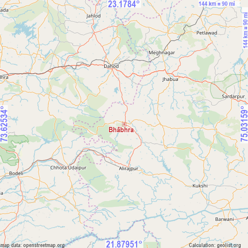
Bhābhra GPS coordinates[2]
22° 31' 49.728" North, 74° 19' 42.456" East
| Map corner | latitude | longitude |
|---|---|---|
| Upper-left | 23.1784°, | 73.62534° |
| Center: | 22.53048°, | 74.32846° |
| Lower-right: | 21.87951°, | 75.03159° |
| Map W x H: | 144.4×144.4 km | = 89.7×89.7mi |
| max Lat: | 34.9274° ⇑52.9% North |
| Bhābhra: | 22.53048° |
| min Lat: | ⇓47.1% South 8.09008° |
| min Long | Bhābhra | max Long |
| 68.82655° | 74.32846° | 96.81° |
| W 12.2%⇐ | ⇒87.8% E |
Elevation
Elevation of Bhābhra is 369 m = 1211 ft, and this is 73.4 m = 241 ft above average elevation for this country.
| Max E: |
3681 m = 12077 ft | 26.4% |
| Bhābhra | 369 m 1211 ft | |
| Avg. | 295.6 m = 970 ft | |
Min E: |
1 m = 3 ft | 73.6% |
See also: India elevation on elevation.city.
Geographical zone
Bhābhra is located in North Torrid zone (between Equator and Tropic of Cancer). Distance of this Northern Tropic circle is 100.8 km =62.6 mi to North.| Distance of | km | miles | from Bhābhra |
|---|---|---|---|
| North Pole | 7501.9 | 4661.5 | to North |
| Arctic Circle | 4896 | 3042.2 | to North |
| Tropic Cancer | 100.8 | 62.6 | to North |
| Equator | 2505.2 | 1556.7 | to South |


Nearby cities:
15 places around Bhābhra: (largest is in red/bold)
• Bāg
51.2 km =31.8 mi,  111°
111°
• Chhota Udepur
40.8 km =25.4 mi,  231°
231°
• Devgadh Bāriya
47.2 km =29.3 mi,  294°
294°
• Dohad
34.3 km =21.3 mi,  348°
348°
• Jetpur
54.2 km =33.7 mi,  247°
247°
• Jhābua
37.7 km =23.4 mi,  45°
45°
• Jobat
27.7 km =17.2 mi,  117°
117°
• Kawānt
56.4 km =35 mi,  210°
210°
• Kukshi
57 km =35.4 mi,  129°
129°
• Morwa
65.2 km =40.5 mi,  309°
309°
• Petlāwad
71.9 km =44.7 mi,  42°
42°
• Rajpur
25.3 km =15.7 mi,  173°
173°
• Rājgarh
65.4 km =40.6 mi,  75°
75°
• Rānāpur
23.7 km =14.7 mi,  56°
56°
• Thandla
59.1 km =36.7 mi,  25°
25°
Sources, notices
• [Note1] Compared only with cities in India existing in our database
• [Src1] Map data: © OpenStreetMap contributors (CC-BY-SA)
• [Src2] Other city data from geonames.org with taken over terms of usage.
• [Src3] Geographical zone / Annual Mean Temperature by Robert A. Rohde @ Wikipedia
