Rānāpur geodata
Rānāpur (Madhya Pradesh) is a populated place; located in India in Asia/Kolkata (GMT+5.5) time zone. With population of 10,675 people, there are 2872 cities with bigger population in this country. Compared to other cities in India, 51.6% of cities are located further ↑North; 86.7% of cities are located further →East and 74.3% of cities have lower elevation than Rānāpur. Note1


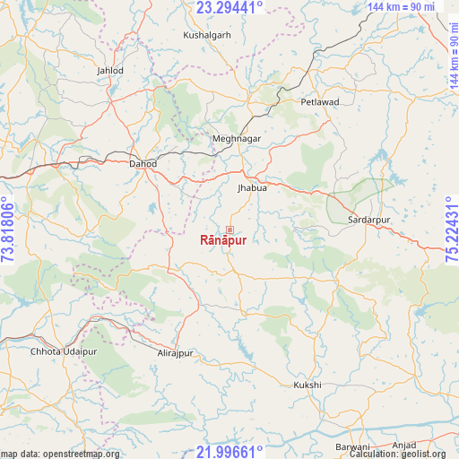
Rānāpur GPS coordinates[2]
22° 38' 49.344" North, 74° 31' 16.248" East
| Map corner | latitude | longitude |
|---|---|---|
| Upper-left | 23.29441°, | 73.81806° |
| Center: | 22.64704°, | 74.52118° |
| Lower-right: | 21.99661°, | 75.22431° |
| Map W x H: | 144.3×144.3 km | = 89.7×89.7mi |
| max Lat: | 34.9274° ⇑51.6% North |
| Rānāpur: | 22.64704° |
| min Lat: | ⇓48.4% South 8.09008° |
| min Long | Rānāpur | max Long |
| 68.82655° | 74.52118° | 96.81° |
| W 13.3%⇐ | ⇒86.7% E |
Elevation
Elevation of Rānāpur is 377 m = 1237 ft, and this is 81.4 m = 267 ft above average elevation for this country.
| Max E: |
3681 m = 12077 ft | 25.7% |
| Rānāpur | 377 m 1237 ft | |
| Avg. | 295.6 m = 970 ft | |
Min E: |
1 m = 3 ft | 74.3% |
See also: India elevation on elevation.city.
Geographical zone
Rānāpur is located in North Torrid zone (between Equator and Tropic of Cancer). Distance of this Northern Tropic circle is 87.8 km =54.6 mi to North.| Distance of | km | miles | from Rānāpur |
|---|---|---|---|
| North Pole | 7488.9 | 4653.4 | to North |
| Arctic Circle | 4883.1 | 3034.2 | to North |
| Tropic Cancer | 87.8 | 54.6 | to North |
| Equator | 2518.1 | 1564.7 | to South |


Nearby cities:
15 places around Rānāpur: (largest is in red/bold)
• Bamna
55.5 km =34.5 mi,  26°
26°
• Bhābhra
23.7 km =14.7 mi,  236°
236°
• Bāg
42.3 km =26.3 mi,  139°
139°
• Chhota Udepur
64.4 km =40 mi,  233°
233°
• Devgadh Bāriya
63.2 km =39.3 mi,  275°
275°
• Dohad
33.8 km =21 mi,  307°
307°
• Jhābua
15.2 km =9.4 mi, 28°
• Jobat
26.1 km =16.2 mi,  169°
169°
• Kukshi
54.7 km =34 mi,  153°
153°
• Kushālgarh
61.8 km =38.4 mi,  353°
353°
• Manāwar
74.2 km =46.1 mi,  128°
128°
• Petlāwad
49.4 km =30.7 mi,  35°
35°
• Rajpur
41.8 km =26 mi,  204°
204°
• Rājgarh
43.6 km =27.1 mi,  85°
85°
• Thandla
40.7 km =25.3 mi,  8°
8°
Sources, notices
• [Note1] Compared only with cities in India existing in our database
• [Src1] Map data: © OpenStreetMap contributors (CC-BY-SA)
• [Src2] Other city data from geonames.org with taken over terms of usage.
• [Src3] Geographical zone / Annual Mean Temperature by Robert A. Rohde @ Wikipedia
