Bāg geodata
Bāg (Madhya Pradesh) is a populated place; located in India in Asia/Kolkata (GMT+5.5) time zone. With population of 7,764 people, there are 3143 cities with bigger population in this country. Compared to other cities in India, 54% of cities are located further ↑North; 84.4% of cities are located further →East and 57.7% of cities have lower elevation than Bāg. Note1


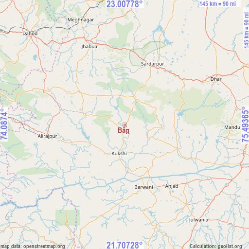
Bāg GPS coordinates[2]
22° 21' 32.58" North, 74° 47' 25.872" East
| Map corner | latitude | longitude |
|---|---|---|
| Upper-left | 23.00778°, | 74.0874° |
| Center: | 22.35905°, | 74.79052° |
| Lower-right: | 21.70728°, | 75.49365° |
| Map W x H: | 144.6×144.6 km | = 89.9×89.9mi |
| max Lat: | 34.9274° ⇑54% North |
| Bāg: | 22.35905° |
| min Lat: | ⇓46% South 8.09008° |
| min Long | Bāg | max Long |
| 68.82655° | 74.79052° | 96.81° |
| W 15.6%⇐ | ⇒84.4% E |
Elevation
Elevation of Bāg is 238 m = 781 ft, and this is 57.6 m = 189 ft below average elevation for this country.
| Max E: |
3681 m = 12077 ft | 42.3% |
| Avg. | 295.6 m = 970 ft | |
| Bāg | 238 m = 781 ft | |
Min E: |
1 m = 3 ft | 57.7% |
See also: India elevation on elevation.city.
Geographical zone
Bāg is located in North Torrid zone (between Equator and Tropic of Cancer). Distance of this Northern Tropic circle is 119.8 km =74.4 mi to North.| Distance of | km | miles | from Bāg |
|---|---|---|---|
| North Pole | 7521 | 4673.3 | to North |
| Arctic Circle | 4915.1 | 3054.1 | to North |
| Tropic Cancer | 119.8 | 74.4 | to North |
| Equator | 2486.1 | 1544.8 | to South |


Nearby cities:
15 places around Bāg: (largest is in red/bold)
• Anjad
44.6 km =27.7 mi,  142°
142°
• Barwāni
38 km =23.6 mi,  162°
162°
• Bhābhra
51.2 km =31.8 mi,  291°
291°
• Dharampuri
61.6 km =38.3 mi,  112°
112°
• Dhāmnod
71.9 km =44.7 mi,  103°
103°
• Dhār
58.3 km =36.2 mi,  63°
63°
• Jhābua
49.8 km =30.9 mi,  335°
335°
• Jobat
23.7 km =14.7 mi, 285°
• Kukshi
17.3 km =10.7 mi,  191°
191°
• Manāwar
33.6 km =20.9 mi, 114°
• Petlāwad
72.5 km =45 mi,  0°
0°
• Rajpur
45.1 km =28 mi,  262°
262°
• Rajpur
58.6 km =36.4 mi, 142°
• Rājgarh
38.9 km =24.2 mi,  24°
24°
• Rānāpur
42.3 km =26.3 mi,  319°
319°
Sources, notices
• [Note1] Compared only with cities in India existing in our database
• [Src1] Map data: © OpenStreetMap contributors (CC-BY-SA)
• [Src2] Other city data from geonames.org with taken over terms of usage.
• [Src3] Geographical zone / Annual Mean Temperature by Robert A. Rohde @ Wikipedia
