Basavakalyān geodata
Basavakalyān (Karnataka) is a populated place; located in India in Asia/Kolkata (GMT+5.5) time zone. With population of 65,805 people, there are 663 cities with bigger population in this country. Compared to other cities in India, 72.1% of cities are located further ↑North; 63.7% of cities are located further →East and 89.8% of cities have lower elevation than Basavakalyān. Note1


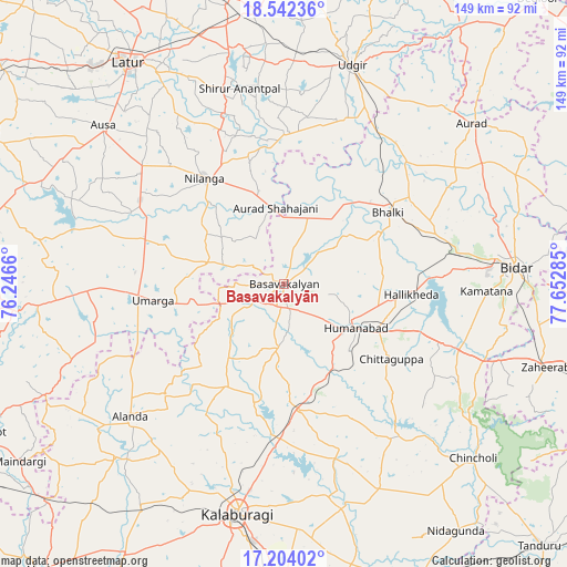
Basavakalyān GPS coordinates[2]
17° 52' 28.02" North, 76° 56' 58.992" East
| Map corner | latitude | longitude |
|---|---|---|
| Upper-left | 18.54236°, | 76.2466° |
| Center: | 17.87445°, | 76.94972° |
| Lower-right: | 17.20402°, | 77.65285° |
| Map W x H: | 148.8×148.8 km | = 92.5×92.5mi |
| max Lat: | 34.9274° ⇑72.1% North |
| Basavakalyān: | 17.87445° |
| min Lat: | ⇓27.9% South 8.09008° |
| min Long | Basavakalyān | max Long |
| 68.82655° | 76.94972° | 96.81° |
| W 36.3%⇐ | ⇒63.7% E |
Elevation
Elevation of Basavakalyān is 631 m = 2070 ft, and this is 335.4 m = 1100 ft above average elevation for this country.
| Max E: |
3681 m = 12077 ft | 10.2% |
| Basavakalyān | 631 m 2070 ft | |
| Avg. | 295.6 m = 970 ft | |
Min E: |
1 m = 3 ft | 89.8% |
See also: Basavakalyān elevation on elevation.city.
Geographical zone
Basavakalyān is located in North Torrid zone (between Equator and Tropic of Cancer). Distance of this Northern Tropic circle is 618.5 km =384.3 mi to North.| Distance of | km | miles | from Basavakalyān |
|---|---|---|---|
| North Pole | 8019.6 | 4983.1 | to North |
| Arctic Circle | 5413.7 | 3363.9 | to North |
| Tropic Cancer | 618.5 | 384.3 | to North |
| Equator | 1987.5 | 1235 | to South |


Nearby cities:
15 places around Basavakalyān: (largest is in red/bold)
• Aland
53.1 km =33 mi,  229°
229°
• Aurād
65 km =40.4 mi,  49°
49°
• Ausa
63.1 km =39.2 mi,  311°
311°
• Bhālki
33 km =20.5 mi,  55°
55°
• Bīdar
61.6 km =38.3 mi,  85°
85°
• Chincholi
67.4 km =41.9 mi,  132°
132°
• Gulbarga
61.1 km =38 mi,  191°
191°
• Homnābād
21.9 km =13.6 mi,  121°
121°
• Latur
70.8 km =44 mi,  325°
325°
• Moram
51.6 km =32.1 mi,  259°
259°
• Naldurg
71 km =44.1 mi, 264°
• Nilanga
34.1 km =21.2 mi,  322°
322°
• Udgīr
60.3 km =37.5 mi,  17°
17°
• Umarga
34.8 km =21.6 mi, 263°
• Zahirābād
72.9 km =45.3 mi,  107°
107°
Sources, notices
• [Note1] Compared only with cities in India existing in our database
• [Src1] Map data: © OpenStreetMap contributors (CC-BY-SA)
• [Src2] Other city data from geonames.org with taken over terms of usage.
• [Src3] Geographical zone / Annual Mean Temperature by Robert A. Rohde @ Wikipedia
