Barpathār geodata
Barpathār (Assam) is a populated place; located in India in Asia/Kolkata (GMT+5.5) time zone. With population of 7,445 people, there are 3176 cities with bigger population in this country. Compared to other cities in India, 72.9% of cities are located further ↓South; 98.5% of cities are located further ←West and 64.6% of cities have higher elevation than Barpathār. Note1


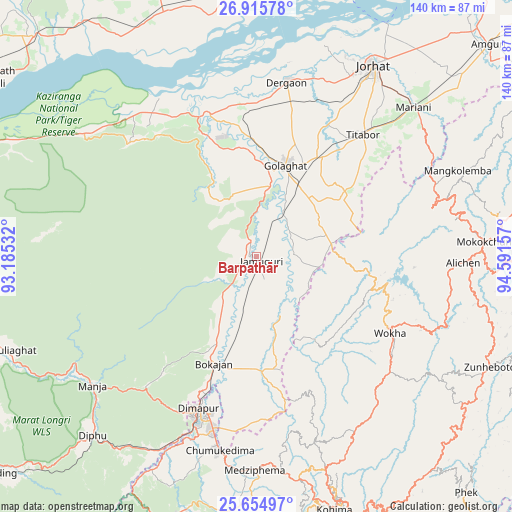
Barpathār GPS coordinates[2]
26° 17' 13.524" North, 93° 53' 18.384" East
| Map corner | latitude | longitude |
|---|---|---|
| Upper-left | 26.91578°, | 93.18532° |
| Center: | 26.28709°, | 93.88844° |
| Lower-right: | 25.65497°, | 94.59157° |
| Map W x H: | 140.2×140.2 km | = 87.1×87.1mi |
| max Lat: | 34.9274° ⇑27.1% North |
| Barpathār: | 26.28709° |
| min Lat: | ⇓72.9% South 8.09008° |
| min Long | Barpathār | max Long |
| 68.82655° | 93.88844° | 96.81° |
| W 98.5%⇐ | ⇒1.5% E |
Elevation
Elevation of Barpathār is 123 m = 404 ft, and this is 172.6 m = 566 ft below average elevation for this country.
| Max E: |
3681 m = 12077 ft | 64.6% |
| Avg. | 295.6 m = 970 ft | |
| Barpathār | 123 m = 404 ft | |
Min E: |
1 m = 3 ft | 35.4% |
See also: India elevation on elevation.city.
Geographical zone
Barpathār is located in North temperate zone (between Tropic of Cancer and the Arctic Circle). Distance of this Northern Tropic circle is 316.9 km =196.9 mi to South.| Distance of | km | miles | from Barpathār |
|---|---|---|---|
| North Pole | 7084.2 | 4401.9 | to North |
| Arctic Circle | 4478.3 | 2782.7 | to North |
| Tropic Cancer | 316.9 | 196.9 | to South |
| Equator | 2922.9 | 1816.2 | to South |


Nearby cities:
15 places around Barpathār: (largest is in red/bold)
• Bokajān
31.5 km =19.6 mi,  200°
200°
• Bokākhāt
48.6 km =30.2 mi,  323°
323°
• Dergaon
46.6 km =29 mi,  9°
9°
• Dimāpur
44.9 km =27.9 mi, 201°
• Diphu
67.2 km =41.8 mi,  222°
222°
• Gohpur
71.5 km =44.4 mi,  337°
337°
• Golāghāt
26 km =16.2 mi,  15°
15°
• Jorhāt
61 km =37.9 mi,  30°
30°
• Kohima
71.6 km =44.5 mi,  161°
161°
• Mariāni
59.2 km =36.8 mi,  45°
45°
• Mokokchūng
62.9 km =39.1 mi,  86°
86°
• Numāligarh
40.8 km =25.4 mi, 336°
• Titābar
47 km =29.2 mi,  41°
41°
• Wokha
42.5 km =26.4 mi,  119°
119°
• Zunheboto
72.1 km =44.8 mi, 119°
Sources, notices
• [Note1] Compared only with cities in India existing in our database
• [Src1] Map data: © OpenStreetMap contributors (CC-BY-SA)
• [Src2] Other city data from geonames.org with taken over terms of usage.
• [Src3] Geographical zone / Annual Mean Temperature by Robert A. Rohde @ Wikipedia
