Dimāpur geodata
Dimāpur (Nagaland) is a populated place; located in India in Asia/Kolkata (GMT+5.5) time zone. With population of 135,860 people, there are 319 cities with bigger population in this country. Compared to other cities in India, 69.8% of cities are located further ↓South; 98.3% of cities are located further ←West and 58.7% of cities have higher elevation than Dimāpur. Note1


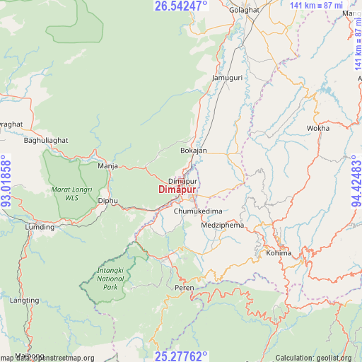
Dimāpur GPS coordinates[2]
25° 54' 42.264" North, 93° 43' 18.12" East
| Map corner | latitude | longitude |
|---|---|---|
| Upper-left | 26.54247°, | 93.01858° |
| Center: | 25.91174°, | 93.7217° |
| Lower-right: | 25.27762°, | 94.42483° |
| Map W x H: | 140.6×140.6 km | = 87.4×87.4mi |
| max Lat: | 34.9274° ⇑30.2% North |
| Dimāpur: | 25.91174° |
| min Lat: | ⇓69.8% South 8.09008° |
| min Long | Dimāpur | max Long |
| 68.82655° | 93.7217° | 96.81° |
| W 98.3%⇐ | ⇒1.7% E |
Elevation
Elevation of Dimāpur is 154 m = 505 ft, and this is 141.6 m = 465 ft below average elevation for this country.
| Max E: |
3681 m = 12077 ft | 58.7% |
| Avg. | 295.6 m = 970 ft | |
| Dimāpur | 154 m = 505 ft | |
Min E: |
1 m = 3 ft | 41.3% |
See also: Dimāpur elevation on elevation.city.
Geographical zone
Dimāpur is located in North temperate zone (between Tropic of Cancer and the Arctic Circle). Distance of this Northern Tropic circle is 275.2 km =171 mi to South.| Distance of | km | miles | from Dimāpur |
|---|---|---|---|
| North Pole | 7125.9 | 4427.8 | to North |
| Arctic Circle | 4520.1 | 2808.7 | to North |
| Tropic Cancer | 275.2 | 171 | to South |
| Equator | 2881.1 | 1790.2 | to South |


Nearby cities:
15 places around Dimāpur: (largest is in red/bold)
• Barpathār
44.9 km =27.9 mi,  21°
21°
• Bokajān
13.5 km =8.4 mi,  25°
25°
• Bokākhāt
81.9 km =50.9 mi,  351°
351°
• Diphu
30 km =18.6 mi,  255°
255°
• Golāghāt
70.8 km =44 mi, 19°
• Hojāi
87.1 km =54.1 mi,  276°
276°
• Kohima
47 km =29.2 mi,  124°
124°
• Kāngpokpi
88 km =54.7 mi,  163°
163°
• Lumding Railway Colony
58.1 km =36.1 mi,  251°
251°
• Maibong
89.6 km =55.7 mi,  220°
220°
• Numāligarh
79 km =49.1 mi,  0°
0°
• Phek
82.5 km =51.3 mi,  109°
109°
• Titābar
90.5 km =56.2 mi, 32°
• Wokha
57.4 km =35.7 mi,  68°
68°
• Zunheboto
79.7 km =49.5 mi,  85°
85°
Sources, notices
• [Note1] Compared only with cities in India existing in our database
• [Src1] Map data: © OpenStreetMap contributors (CC-BY-SA)
• [Src2] Other city data from geonames.org with taken over terms of usage.
• [Src3] Geographical zone / Annual Mean Temperature by Robert A. Rohde @ Wikipedia
