Anshing geodata
Anshing (Maharashtra) is a populated place; located in India in Asia/Kolkata (GMT+5.5) time zone. With population of 19,000 people, there are 2123 cities with bigger population in this country. Compared to other cities in India, 65.1% of cities are located further ↑North; 59.5% of cities are located further →East and 85% of cities have lower elevation than Anshing. Note1


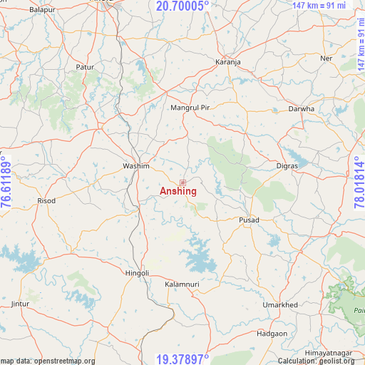
Anshing GPS coordinates[2]
20° 2' 27.24" North, 77° 18' 54.036" East
| Map corner | latitude | longitude |
|---|---|---|
| Upper-left | 20.70005°, | 76.61189° |
| Center: | 20.0409°, | 77.31501° |
| Lower-right: | 19.37897°, | 78.01814° |
| Map W x H: | 146.9×146.9 km | = 91.3×91.3mi |
| max Lat: | 34.9274° ⇑65.1% North |
| Anshing: | 20.0409° |
| min Lat: | ⇓34.9% South 8.09008° |
| min Long | Anshing | max Long |
| 68.82655° | 77.31501° | 96.81° |
| W 40.5%⇐ | ⇒59.5% E |
Elevation
Elevation of Anshing is 549 m = 1801 ft, and this is 253.4 m = 831 ft above average elevation for this country.
| Max E: |
3681 m = 12077 ft | 15% |
| Anshing | 549 m 1801 ft | |
| Avg. | 295.6 m = 970 ft | |
Min E: |
1 m = 3 ft | 85% |
See also: India elevation on elevation.city.
Geographical zone
Anshing is located in North Torrid zone (between Equator and Tropic of Cancer). Distance of this Northern Tropic circle is 377.6 km =234.6 mi to North.| Distance of | km | miles | from Anshing |
|---|---|---|---|
| North Pole | 7778.7 | 4833.5 | to North |
| Arctic Circle | 5172.8 | 3214.2 | to North |
| Tropic Cancer | 377.6 | 234.6 | to North |
| Equator | 2228.3 | 1384.6 | to South |


Nearby cities:
15 places around Anshing: (largest is in red/bold)
• Basmat
80.9 km =50.3 mi,  191°
191°
• Digras
42.7 km =26.5 mi,  80°
80°
• Dārwha
56.4 km =35 mi,  57°
57°
• Hadgāon
70.5 km =43.8 mi,  149°
149°
• Hingoli
40.5 km =25.2 mi,  206°
206°
• Kalamnūri
40.8 km =25.4 mi,  180°
180°
• Kāranja
52.4 km =32.6 mi,  20°
20°
• Mangrūl Pīr
30.5 km =19 mi,  5°
5°
• Mehekar
78.9 km =49 mi,  278°
278°
• Murtajāpur
77.1 km =47.9 mi,  4°
4°
• Pusad
31 km =19.3 mi,  117°
117°
• Pātūr
61.1 km =38 mi,  319°
319°
• Risod
55.5 km =34.5 mi,  262°
262°
• Umarkhed
62.6 km =38.9 mi,  141°
141°
• Wāshīm
20.6 km =12.8 mi,  292°
292°
Sources, notices
• [Note1] Compared only with cities in India existing in our database
• [Src1] Map data: © OpenStreetMap contributors (CC-BY-SA)
• [Src2] Other city data from geonames.org with taken over terms of usage.
• [Src3] Geographical zone / Annual Mean Temperature by Robert A. Rohde @ Wikipedia
