Risod geodata
Risod (Maharashtra) is a populated place; located in India in Asia/Kolkata (GMT+5.5) time zone. With population of 30,131 people, there are 1439 cities with bigger population in this country. Compared to other cities in India, 65.3% of cities are located further ↑North; 65.2% of cities are located further →East and 84.5% of cities have lower elevation than Risod. Note1


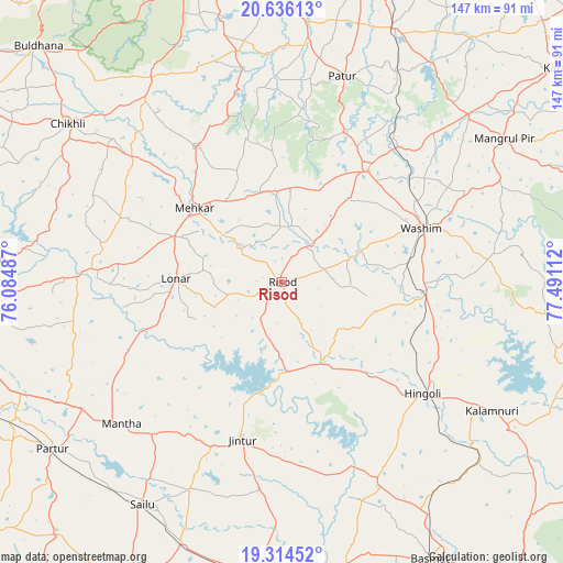
Risod GPS coordinates[2]
19° 58' 36.156" North, 76° 47' 16.764" East
| Map corner | latitude | longitude |
|---|---|---|
| Upper-left | 20.63613°, | 76.08487° |
| Center: | 19.97671°, | 76.78799° |
| Lower-right: | 19.31452°, | 77.49112° |
| Map W x H: | 146.9×147 km | = 91.3×91.3mi |
| max Lat: | 34.9274° ⇑65.3% North |
| Risod: | 19.97671° |
| min Lat: | ⇓34.7% South 8.09008° |
| min Long | Risod | max Long |
| 68.82655° | 76.78799° | 96.81° |
| W 34.8%⇐ | ⇒65.2% E |
Elevation
Elevation of Risod is 542 m = 1778 ft, and this is 246.4 m = 808 ft above average elevation for this country.
| Max E: |
3681 m = 12077 ft | 15.5% |
| Risod | 542 m 1778 ft | |
| Avg. | 295.6 m = 970 ft | |
Min E: |
1 m = 3 ft | 84.5% |
See also: India elevation on elevation.city.
Geographical zone
Risod is located in North Torrid zone (between Equator and Tropic of Cancer). Distance of this Northern Tropic circle is 384.7 km =239 mi to North.| Distance of | km | miles | from Risod |
|---|---|---|---|
| North Pole | 7785.9 | 4837.9 | to North |
| Arctic Circle | 5180 | 3218.7 | to North |
| Tropic Cancer | 384.7 | 239 | to North |
| Equator | 2221.2 | 1380.2 | to South |


Nearby cities:
15 places around Risod: (largest is in red/bold)
• Anshing
55.5 km =34.5 mi,  82°
82°
• Bālāpur
76.7 km =47.7 mi,  358°
358°
• Chikhli
69.2 km =43 mi,  306°
306°
• Deūlgaon Rāja
78.5 km =48.8 mi,  273°
273°
• Hingoli
47.1 km =29.3 mi,  128°
128°
• Jintūr
41.9 km =26 mi,  194°
194°
• Kalamnūri
64.3 km =40 mi,  121°
121°
• Lonār
28 km =17.4 mi, 271°
• Mangrūl Pīr
68.9 km =42.8 mi,  57°
57°
• Mehekar
30 km =18.6 mi, 310°
• Parbhani
78.8 km =49 mi,  181°
181°
• Partūr
73.1 km =45.4 mi,  234°
234°
• Pātūr
56 km =34.8 mi,  16°
16°
• Selu
68.4 km =42.5 mi,  212°
212°
• Wāshīm
39 km =24.2 mi,  67°
67°
Sources, notices
• [Note1] Compared only with cities in India existing in our database
• [Src1] Map data: © OpenStreetMap contributors (CC-BY-SA)
• [Src2] Other city data from geonames.org with taken over terms of usage.
• [Src3] Geographical zone / Annual Mean Temperature by Robert A. Rohde @ Wikipedia
