Anandpur geodata
Anandpur (Punjab) is a populated place; located in India in Asia/Kolkata (GMT+5.5) time zone. With population of 15,229 people, there are 2440 cities with bigger population in this country. Compared to other cities in India, 96.4% of cities are located further ↓South; 68.3% of cities are located further →East and 68.2% of cities have lower elevation than Anandpur. Note1


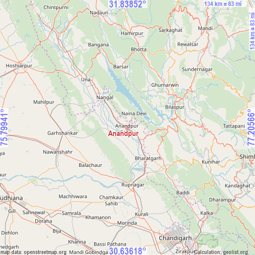
Anandpur GPS coordinates[2]
31° 14' 21.336" North, 76° 30' 9.108" East
| Map corner | latitude | longitude |
|---|---|---|
| Upper-left | 31.83852°, | 75.79941° |
| Center: | 31.23926°, | 76.50253° |
| Lower-right: | 30.63618°, | 77.20566° |
| Map W x H: | 133.7×133.7 km | = 83.1×83.1mi |
| max Lat: | 34.9274° ⇑3.6% North |
| Anandpur: | 31.23926° |
| min Lat: | ⇓96.4% South 8.09008° |
| min Long | Anandpur | max Long |
| 68.82655° | 76.50253° | 96.81° |
| W 31.7%⇐ | ⇒68.3% E |
Elevation
Elevation of Anandpur is 309 m = 1014 ft, and this is 13.4 m = 44 ft above average elevation for this country.
| Max E: |
3681 m = 12077 ft | 31.8% |
| Anandpur | 309 m 1014 ft | |
| Avg. | 295.6 m = 970 ft | |
Min E: |
1 m = 3 ft | 68.2% |
See also: India elevation on elevation.city.
Geographical zone
Anandpur is located in North temperate zone (between Tropic of Cancer and the Arctic Circle). Distance of this Northern Tropic circle is 867.6 km =539.1 mi to South.| Distance of | km | miles | from Anandpur |
|---|---|---|---|
| North Pole | 6533.6 | 4059.8 | to North |
| Arctic Circle | 3927.7 | 2440.6 | to North |
| Tropic Cancer | 867.6 | 539.1 | to South |
| Equator | 3473.5 | 2158.3 | to South |


Nearby cities:
15 places around Anandpur: (largest is in red/bold)
• Arki
45.2 km =28.1 mi,  102°
102°
• Baddi
41.7 km =25.9 mi,  138°
138°
• Bilaspur
26.2 km =16.3 mi,  67°
67°
• Bālāchor
27.6 km =17.1 mi,  223°
223°
• Garhshankar
34.4 km =21.4 mi,  265°
265°
• Ghumārwīn
30.2 km =18.8 mi,  41°
41°
• Māchhīwāra
46.1 km =28.6 mi, 218°
• Nangal
20.6 km =12.8 mi,  324°
324°
• Nawanshahr
38.9 km =24.2 mi,  250°
250°
• Nālāgarh
30.4 km =18.9 mi, 136°
• Nūrpur Kalān
8.3 km =5.2 mi,  192°
192°
• Ropar
30.1 km =18.7 mi,  175°
175°
• Rāhon
42 km =26.1 mi,  240°
240°
• Santokhgarh
21.6 km =13.4 mi,  305°
305°
• Una
33.5 km =20.8 mi, 318°
Sources, notices
• [Note1] Compared only with cities in India existing in our database
• [Src1] Map data: © OpenStreetMap contributors (CC-BY-SA)
• [Src2] Other city data from geonames.org with taken over terms of usage.
• [Src3] Geographical zone / Annual Mean Temperature by Robert A. Rohde @ Wikipedia
