Khānaqīn geodata
Khānaqīn (Diyālá) is a seat of a second-order administrative division; located in Iraq in Asia/Baghdad (GMT+3) time zone. In our database, there are 71 cities with bigger population. Compared to other cities in Iraq, 50.7% of cities are located further ↑North; 74.6% of cities are located further ←West and 54.9% of cities have lower elevation than Khānaqīn. Note1


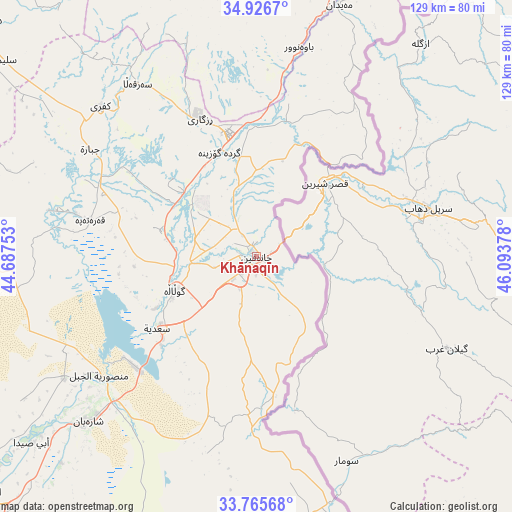
Khānaqīn GPS coordinates[2]
34° 20' 53.52" North, 45° 23' 26.34" East
| Map corner | latitude | longitude |
|---|---|---|
| Upper-left | 34.9267°, | 44.68753° |
| Center: | 34.3482°, | 45.39065° |
| Lower-right: | 33.76568°, | 46.09378° |
| Map W x H: | 129.1×129.1 km | = 80.2×80.2mi |
| max Lat: | 37.22781° ⇑50.7% North |
| Khānaqīn: | 34.3482° |
| min Lat: | ⇓49.3% South 29.97421° |
| min Long | Khānaqīn | max Long |
| 40.28586° | 45.39065° | 48.47309° |
| W 74.6%⇐ | ⇒25.4% E |
Elevation
Elevation of Khānaqīn is 185 m = 607 ft, and this is 108 m = 354 ft below average elevation for this country.
| Max E: |
1316 m = 4318 ft | 45.1% |
| Avg. | 293 m = 961 ft | |
| Khānaqīn | 185 m = 607 ft | |
Min E: |
1 m = 3 ft | 54.9% |
See also: Iraq elevation on elevation.city.
Geographical zone
Khānaqīn is located in North temperate zone (between Tropic of Cancer and the Arctic Circle). Distance of this Northern Tropic circle is 1213.2 km =753.8 mi to South.| Distance of | km | miles | from Khānaqīn |
|---|---|---|---|
| North Pole | 6187.9 | 3845 | to North |
| Arctic Circle | 3582 | 2225.8 | to North |
| Tropic Cancer | 1213.2 | 753.8 | to South |
| Equator | 3819.2 | 2373.1 | to South |


Nearby cities:
15 places around Khānaqīn: (largest is in red/bold)
• Al Khāliş
97.3 km =60.5 mi,  235°
235°
• Al Miqdādīyah
58.6 km =36.4 mi,  225°
225°
• Aţ Ţārmīyah
118.4 km =73.6 mi, 230°
• Baladrūz
78 km =48.5 mi,  201°
201°
• Baqubah
98 km =60.9 mi, 227°
• Derbendîxan
89.1 km =55.4 mi,  17°
17°
• Kelar
31.8 km =19.8 mi,  348°
348°
• Khāliş
99.2 km =61.6 mi, 232°
• Kifrī
54.7 km =34 mi,  313°
313°
• Mandalī
68.4 km =42.5 mi,  167°
167°
• Qeredagh
106.6 km =66.2 mi,  359°
359°
• Seyid Sadiq
119.9 km =74.5 mi, 21°
• Tozkhurmato
91.7 km =57 mi, 310°
• Ḩalabjah
107.1 km =66.5 mi,  30°
30°
• Ḩalabjah al Jadīdah
111.4 km =69.2 mi,  14°
14°
Sources, notices
• [Note1] Compared only with cities in Iraq existing in our database
• [Src1] Map data: © OpenStreetMap contributors (CC-BY-SA)
• [Src2] Other city data from geonames.org with taken over terms of usage.
• [Src3] Geographical zone / Annual Mean Temperature by Robert A. Rohde @ Wikipedia
