Mêrgasur geodata
Mêrgasur (Arbīl) is a seat of a second-order administrative division; located in Iraq in Asia/Baghdad (GMT+3) time zone. In our database, there are 71 cities with bigger population. Compared to other cities in Iraq, 92.3% of cities are located further ↓South; 58.5% of cities are located further →East and 96.5% of cities have lower elevation than Mêrgasur. Note1


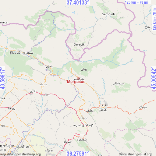
Mêrgasur GPS coordinates[2]
36° 50' 26.484" North, 44° 18' 8.244" East
| Map corner | latitude | longitude |
|---|---|---|
| Upper-left | 37.40133°, | 43.59917° |
| Center: | 36.84069°, | 44.30229° |
| Lower-right: | 36.27591°, | 45.00542° |
| Map W x H: | 125.1×125.1 km | = 77.7×77.7mi |
| max Lat: | 37.22781° ⇑7.7% North |
| Mêrgasur: | 36.84069° |
| min Lat: | ⇓92.3% South 29.97421° |
| min Long | Mêrgasur | max Long |
| 40.28586° | 44.30229° | 48.47309° |
| W 41.5%⇐ | ⇒58.5% E |
Elevation
Elevation of Mêrgasur is 1190 m = 3904 ft, and this is 897 m = 2943 ft above average elevation for this country.
| Max E: |
1316 m = 4318 ft | 3.5% |
| Mêrgasur | 1190 m 3904 ft | |
| Avg. | 293 m = 961 ft | |
Min E: |
1 m = 3 ft | 96.5% |
See also: Iraq elevation on elevation.city.
Geographical zone
Mêrgasur is located in North temperate zone (between Tropic of Cancer and the Arctic Circle). Distance of this Northern Tropic circle is 1490.4 km =926.1 mi to South.| Distance of | km | miles | from Mêrgasur |
|---|---|---|---|
| North Pole | 5910.8 | 3672.8 | to North |
| Arctic Circle | 3304.9 | 2053.6 | to North |
| Tropic Cancer | 1490.4 | 926.1 | to South |
| Equator | 4096.3 | 2545.3 | to South |


Nearby cities:
15 places around Mêrgasur: (largest is in red/bold)
• Al ‘Amādīyah
77.6 km =48.2 mi,  291°
291°
• Beḧirke
63.1 km =39.2 mi,  202°
202°
• Choman
56.9 km =35.4 mi,  113°
113°
• Dare Tû
82.9 km =51.5 mi, 195°
• Erbil
77.6 km =48.2 mi, 199°
• Hīrān
64.9 km =40.3 mi,  164°
164°
• Kasnazān
72.8 km =45.2 mi,  192°
192°
• Nāḩiyat Hīrān
64.6 km =40.1 mi,  165°
165°
• Ruwāndiz
32.2 km =20 mi,  142°
142°
• Shaqlāwah
48.6 km =30.2 mi,  177°
177°
• Soran
30 km =18.6 mi,  134°
134°
• Xebat
84.2 km =52.3 mi,  222°
222°
• Ṟaniye
83.2 km =51.7 mi, 141°
• ‘Aqrah
37.4 km =23.2 mi,  256°
256°
• ‘Aynkāwah
73.2 km =45.5 mi, 202°
Sources, notices
• [Note1] Compared only with cities in Iraq existing in our database
• [Src1] Map data: © OpenStreetMap contributors (CC-BY-SA)
• [Src2] Other city data from geonames.org with taken over terms of usage.
• [Src3] Geographical zone / Annual Mean Temperature by Robert A. Rohde @ Wikipedia
