Rāmīān geodata
Rāmīān (Golestan) is a seat of a second-order administrative division; located in Iran in Asia/Tehran (GMT+3.5) time zone. In our database, there are 232 cities with bigger population. Compared to other cities in Iran, 83.7% of cities are located further ↓South; 77.1% of cities are located further ←West and 78.5% of cities have higher elevation than Rāmīān. Note1


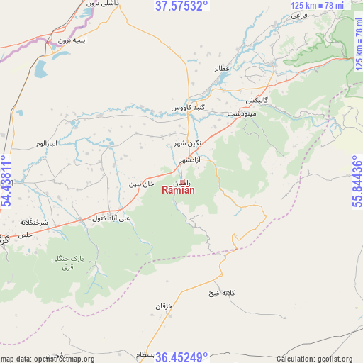
Rāmīān GPS coordinates[2]
37° 0' 57.528" North, 55° 8' 28.428" East
| Map corner | latitude | longitude |
|---|---|---|
| Upper-left | 37.57532°, | 54.43811° |
| Center: | 37.01598°, | 55.14123° |
| Lower-right: | 36.45249°, | 55.84436° |
| Map W x H: | 124.8×124.8 km | = 77.5×77.5mi |
| max Lat: | 39.6482° ⇑16.3% North |
| Rāmīān: | 37.01598° |
| min Lat: | ⇓83.7% South 25.2919° |
| min Long | Rāmīān | max Long |
| 44.38416° | 55.14123° | 61.9965° |
| W 77.1%⇐ | ⇒22.9% E |
Elevation
Elevation of Rāmīān is 222 m = 728 ft, and this is 827 m = 2713 ft below average elevation for this country.
| Max E: |
2564 m = 8412 ft | 78.5% |
| Avg. | 1049 m = 3442 ft | |
| Rāmīān | 222 m = 728 ft | |
Min E: |
-24 m = -79 ft | 21.5% |
See also: Iran elevation on elevation.city.
Geographical zone
Rāmīān is located in North temperate zone (between Tropic of Cancer and the Arctic Circle). Distance of this Northern Tropic circle is 1509.9 km =938.2 mi to South.| Distance of | km | miles | from Rāmīān |
|---|---|---|---|
| North Pole | 5891.3 | 3660.7 | to North |
| Arctic Circle | 3285.4 | 2041.5 | to North |
| Tropic Cancer | 1509.9 | 938.2 | to South |
| Equator | 4115.8 | 2557.4 | to South |


Nearby cities:
15 places around Rāmīān: (largest is in red/bold)
• Aliabad-e Katul
27 km =16.8 mi,  244°
244°
• Bandar-e Torkaman
95.9 km =59.6 mi,  262°
262°
• Garmeh
102 km =63.4 mi,  91°
91°
• Gomīshān
94.7 km =58.8 mi,  273°
273°
• Gonbad-e Kāvūs
26.1 km =16.2 mi,  5°
5°
• Gorgān
64.9 km =40.3 mi,  252°
252°
• Gālīkesh
38.6 km =24 mi,  42°
42°
• Kalāleh
51 km =31.7 mi, 37°
• Kord Kūy
94.8 km =58.9 mi, 254°
• Mīnūdasht
31.4 km =19.5 mi, 40°
• Qarnābād
53.4 km =33.2 mi, 246°
• Shahrud
68.1 km =42.3 mi,  192°
192°
• Āq Qalā
60.9 km =37.8 mi, 269°
• Āq Qāyeh
28.8 km =17.9 mi,  3°
3°
• Āzādshahr
8.3 km =5.2 mi,  19°
19°
Sources, notices
• [Note1] Compared only with cities in Iran existing in our database
• [Src1] Map data: © OpenStreetMap contributors (CC-BY-SA)
• [Src2] Other city data from geonames.org with taken over terms of usage.
• [Src3] Geographical zone / Annual Mean Temperature by Robert A. Rohde @ Wikipedia
